
Hiking Hadrian’s Wall: A Scenic 3-Day Brampton to Chollerford Itinerary
Northern England holds a secret hiding in plain sight. Cut across its spine and you’ll find it: a 73-mile stone scar dragged across moor, ridge, and riverbank by Roman hands around AD 122. Hadrian’s Wall wasn’t just a military structure, it was a statement. This is where Rome ends. Beyond here? Good luck.
I flew into Newcastle, caught a train west toward Carlisle, and picked up the trail at Brampton with nothing but a backpack and a slightly unhinged optimism about October weather. What followed was three days of history colliding head-on with wind, mud, and the occasional confused sheep.
Hadrian’s Wall Path is an 84-mile UNESCO-listed National Trail stretching coast to coast across northern England. This guide covers the most dramatic middle stretch, the part where the Wall still has something to say.
Quick Facts
Location: Northern England — Cumbria & Northumberland
Route covered: Brampton → Greenhead → Once Brewed → Chollerford
Distance: ~50 miles / ~80 km
Difficulty: Moderate — but exposed, undulating, and humbling
Highest point: ~345 m / 1,132 ft
Best for: History lovers, hikers who like big skies + bigger stories, shoulder-season walkers
Most dramatic section: Steel Rigg, Housesteads, Birdoswald
Trail vs. Wall lengthWall: ~73 Roman miles / Trail: ~84 miles end-to-end
What is Hadrian’s Wall
Hadrian’s Wall was the Roman Empire’s northern border for almost 300 years, starting under Emperor Hadrian around AD 122. (English Heritage). It stretched from coast to coast, dotted with milecastles, turrets, and forts, a clear message written in stone: this side is Rome. (English Heritage)
In some spots, the stone wall stood about 15 feet high and was built around 10 Roman feet wide, wide enough for a walkway along the top. (English Heritage)
But what really struck me wasn’t the empire’s power.
It was the power of what’s left.
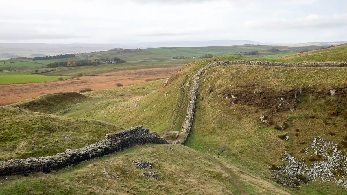
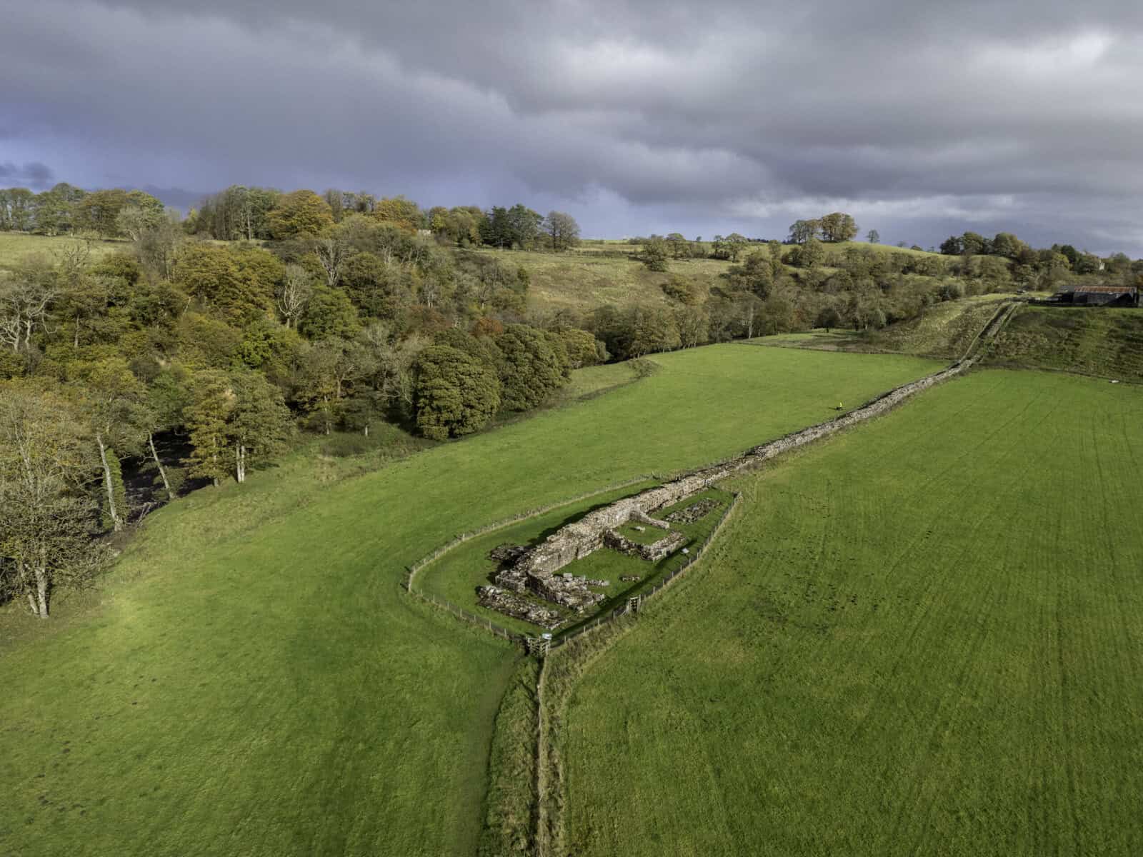
The Wall isn’t continuous anymore. In many places it’s gone, buried, repurposed, or blended into the fields. But in the middle section, it still holds the landscape firmly and refuses to let go.
That’s why I chose this route.
Getting to Hadrian’s Wall
Fly into: Newcastle upon Tyne (NCL)
Train: Newcastle → Carlisle, then onward connections toward Brampton
On the ground: A car helps but isn’t essential. The seasonal AD122 Hadrian’s Wall Country Bus links key sites through the central corridor and is genuinely one of the better pieces of trail logistics in the UK. Mix it with occasional taxi hops and you’re sorted.
Trail start: Brampton
Trail finish: Chollerford
- 👉 Find the perfect hotel
- 🚗 Rent a Car
- 🥾 Find a nearby Trail
- 🧳 Pack the perfect suitcase with these packing cubes
- 👉 All the gear you need for your adventure
- 📱Grab an E-Sim for travel abroad
Money-Saving Tips
Book UK trains early pricing is chaotic and rewards the organised. The AD122 bus dramatically cuts the cost and faff of getting between trailheads. Shoulder season (October in particular) tends to mean cheaper beds, quieter paths, and that specific brand of moody, cinematic atmosphere that makes every photo look intentional. In small villages, eating where you sleep isn’t just convenient it’s often your only option after 7pm.
Best Time to Hike Hadrian’s Wall
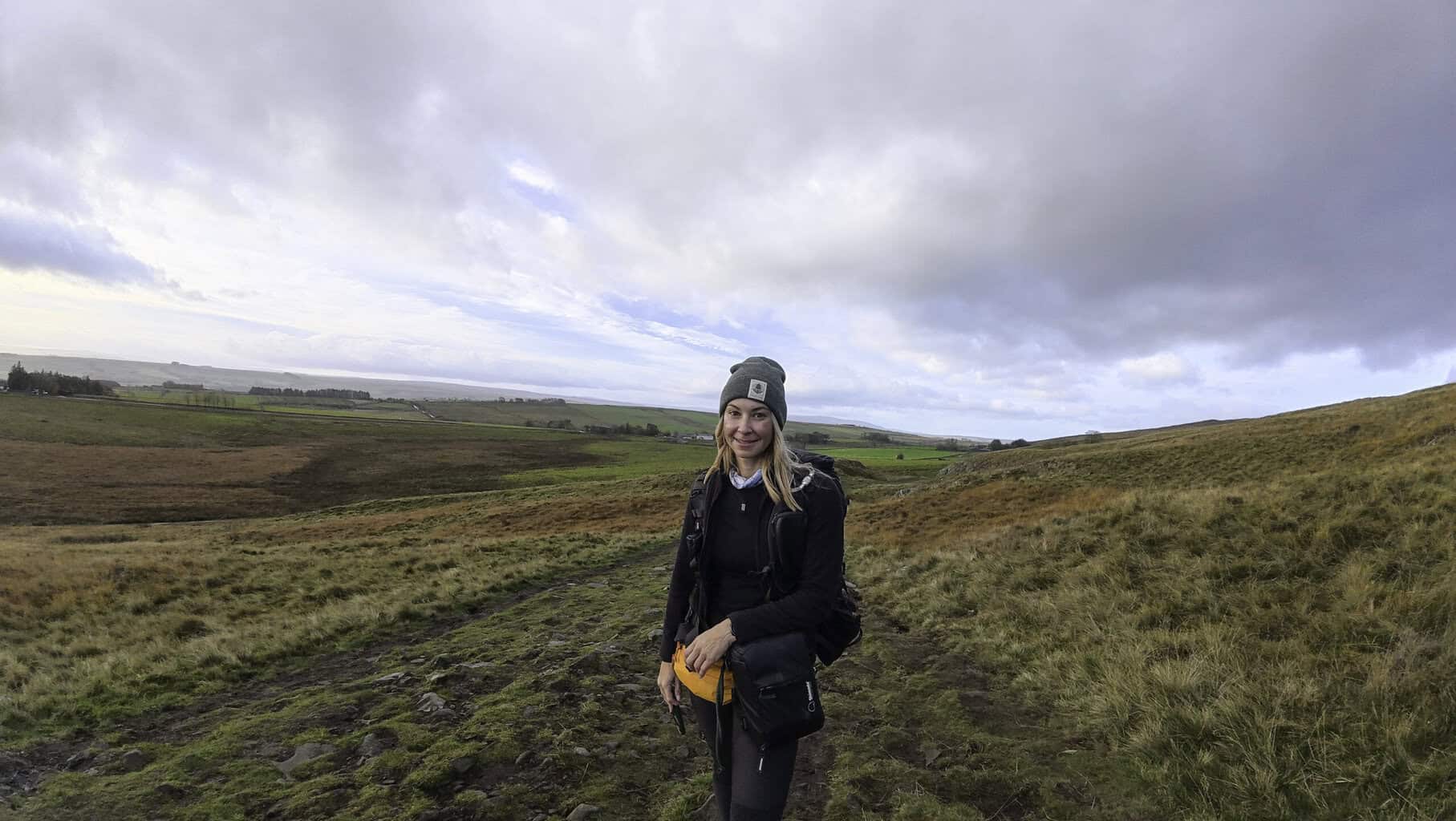
Spring through early autumn is peak season for obvious reasons. But October has its own magic: copper-toned moorland, dramatic skies, and weather with serious personality. Expect wind on the ridges, rain that arrives without warning, and occasional rainbows that feel almost apologetic about the previous hour. Pack accordingly and by “accordingly,” I mean assume you’ll be wet at some point and dress to survive it comfortably rather than avoid it entirely.
Permits, Fees, Reservations
No permit is needed for the trail itself. Individual Roman forts and museums charge entry, budget for at least one or two if you want the history to really land (Housesteads and Birdoswald are worth every penny). Book accommodation well ahead if you’re walking on weekends or during school holidays. Small villages mean small room counts, and they fill up faster than you’d expect.

My 3-Day Brampton to Chollerford Itinerary
Day 1: Brampton to Greenhead
Distance: ~12–20 miles depending on detours Mood: Leaving the modern world behind, one soggy bootprint at a time
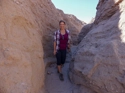
There’s something almost ceremonial about the start of a long walk. I lingered over coffee and a scone in Brampton like it was the last warm handshake before the weather took over. Then the path climbs, gently at first, through sheep-dotted meadows, past a ruined castle, into a landscape that gradually stops caring about the 21st century.
My legs had opinions by mile five. Jetlag has a way of turning easy gradients into personal affronts.
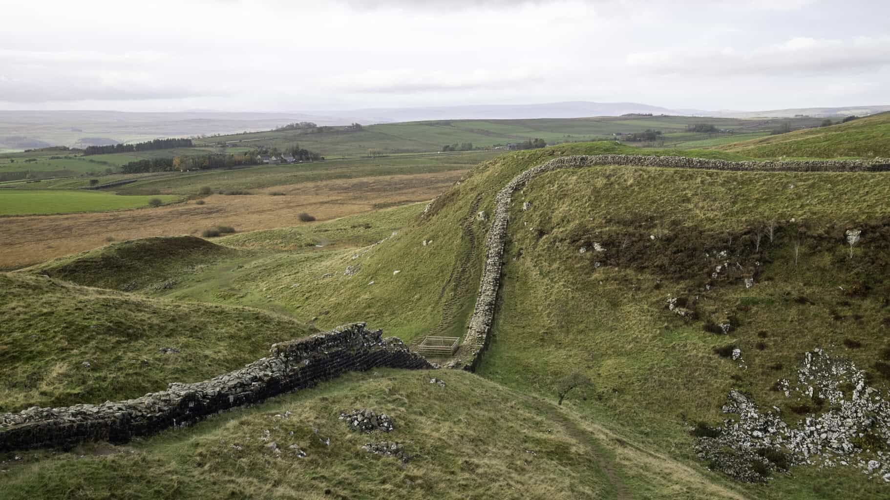
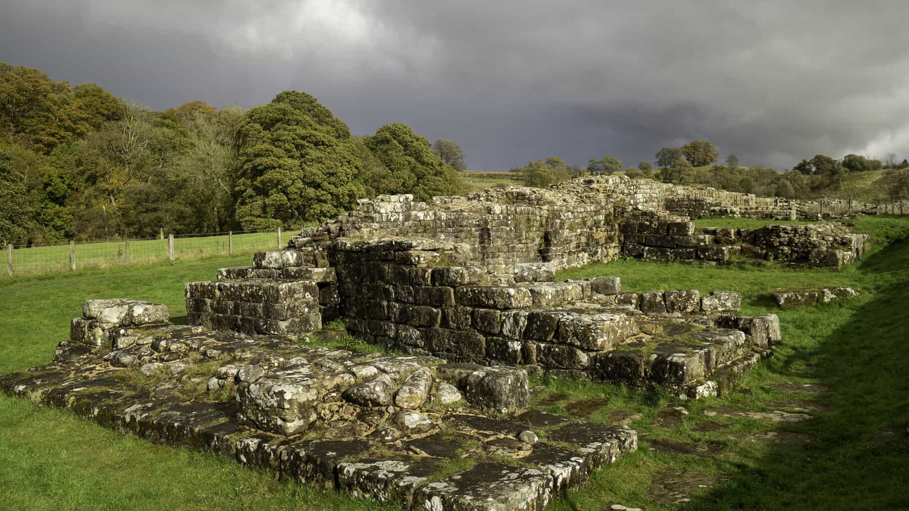
Don’t miss: Birdoswald Roman Fort. This is where you first truly feel the scale of what you’re walking. Birdoswald sits beside the longest continuous surviving stretch of the Wall, and standing there in the October wind, watching rainbows materialize and dissolve over the moors, the timeline does something strange, it collapses. Two thousand years suddenly feels like a very thin membrane.
Arrive in Greenhead cold, possibly damp, and extremely motivated by the prospect of hot food.
Day 2: Greenhead to Once Brewed
Distance: ~7–8 miles Mood: Let history catch up to the scenery
A shorter day by design, legs heavy, weather doing its thing, and the Roman Army Museum waiting along the route to fill in the story your footsteps are walking through. This is the day to slow down, read the plaques, stare at reconstructions of soldiers who stood on the same ground you’re standing on, and genuinely reckon with the improbability of all of it.
Overnight in the Once Brewed / Twice Brewed corridor, the unofficial hub of central Wall walking and home to some of the most walker-friendly accommodation on the trail.

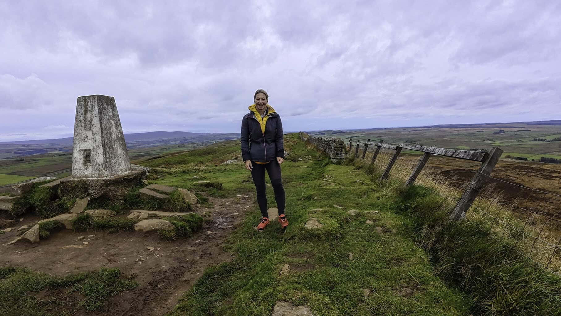
Day 3: Once Brewed to Chollerford
Distance: ~10–13 miles Mood: The Wall becomes a companion, then a ghost
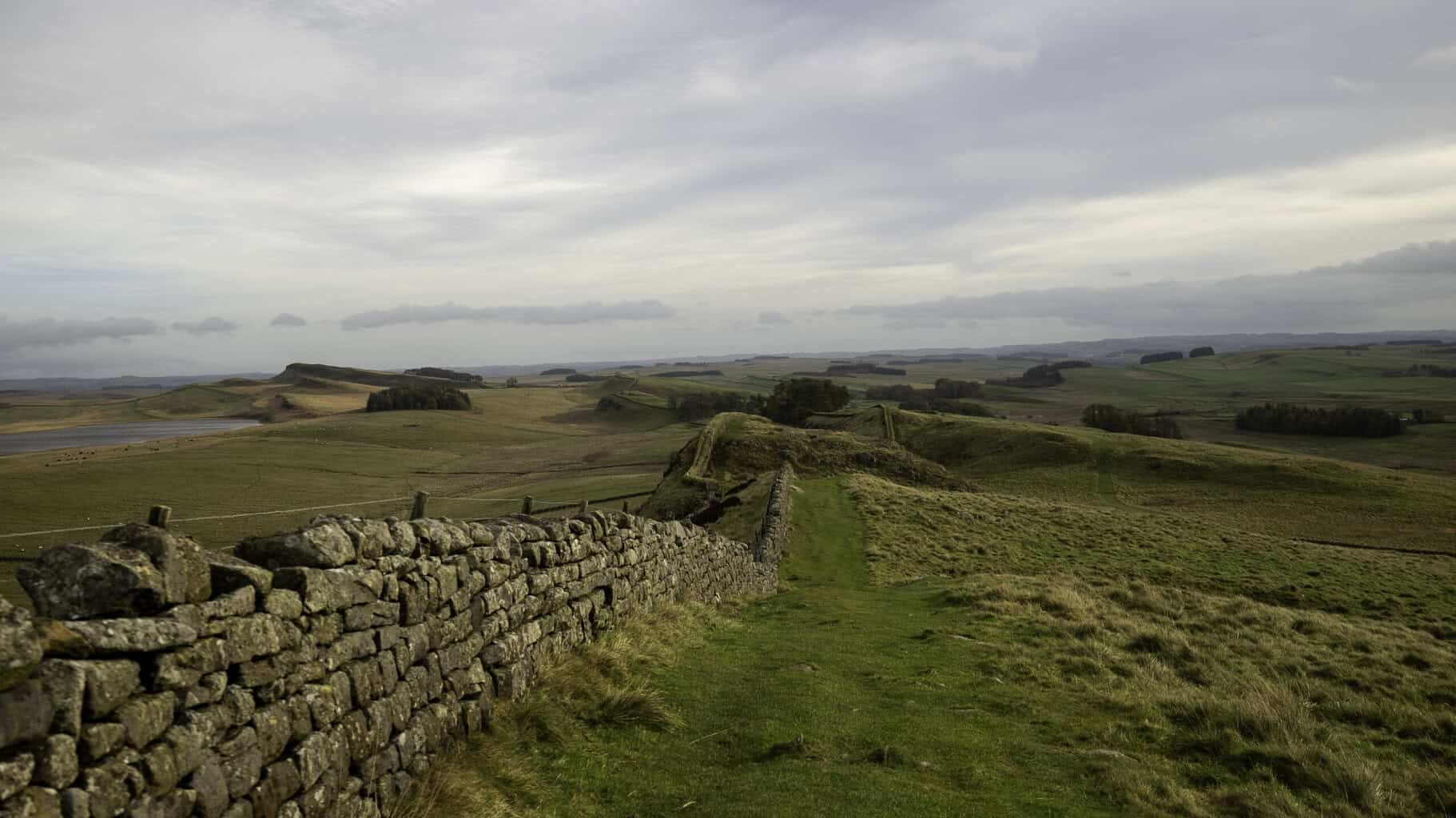
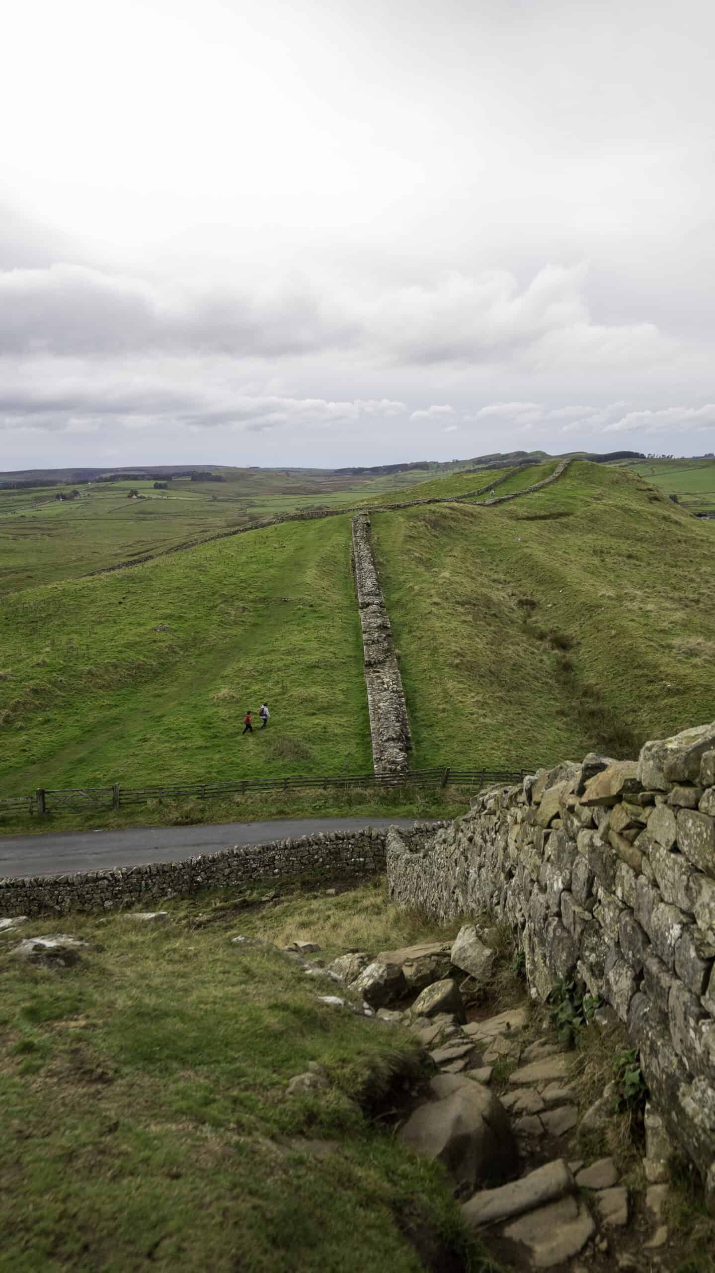
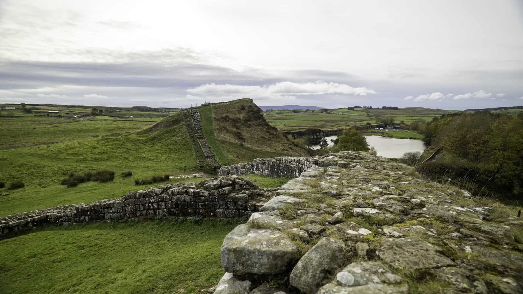
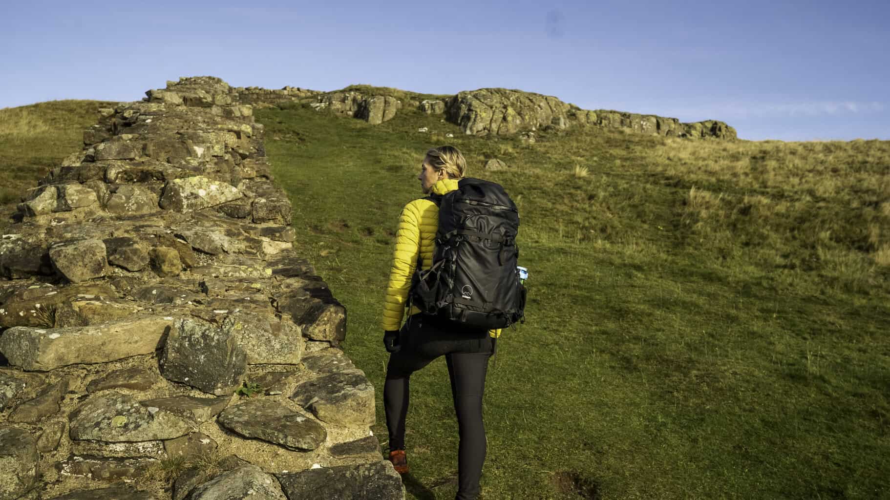
The hardest day. Constant undulation, up, drop, climb, repeat, across open, exposed ridgelines with the wind making its views known. The Wall walks beside you here like an old friend who doesn’t need to talk. When it disappears into the earth, buried or broken, you notice the absence the way you’d notice a familiar sound going silent.
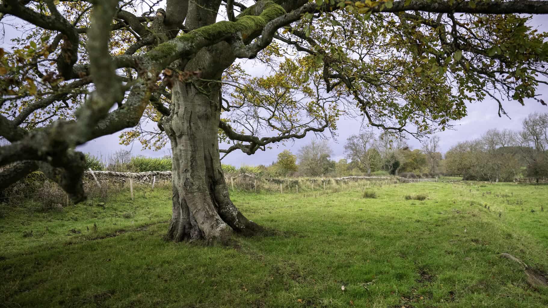
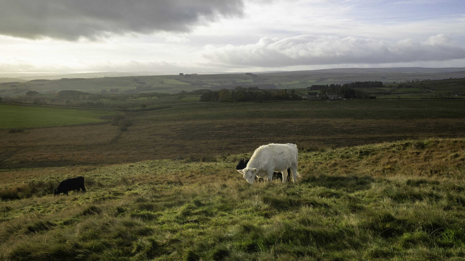
I sang to a field of cows somewhere around mile eight (Tennessee Whiskey, if you’re wondering, they were unimpressed). I stopped at the stump of the Sycamore Gap tree, the iconic lone tree that stood in a dip along the Wall for over 200 years before being deliberately cut down in 2023. Two men were later convicted for the act. The stump is still there. So are the shoots growing from its base, quiet, stubborn, impossibly hopeful.
By the time Chollerford appeared, my body was done and my mind was unusually, completely clear. That specific trail paradox: total exhaustion, total peace.

Trail Notes + Highlights
The middle section is the star of the show, this is where the Wall is most present, the landscape most dramatic, and the solitude most complete. You’ll pass other walkers, but rarely enough to break the quiet. Birdoswald is unmissable. Steel Rigg is the viewpoint that earns its reputation. And Sycamore Gap, even without its tree, carries a strange, melancholy weight worth stopping for.
What to Pack for hiking Hadrian’s Wall
The Non-negotiables:
- Genuinely waterproof jacket and trousers (test it before you trust it)
- Warm midlayer — fleece or packable puffy
- Hat and gloves — ridge wind is a different beast
- Trail shoes with real grip — wet stone and October mud are a combination
- Blister kit (gravel is petty and relentless)
- Offline maps or a GPS device you actually know how to use
- Headlamp — October sunsets come early
- Snacks and electrolytes
- Power bank — cold drains batteries faster than you think
Worth adding:
- Trekking poles for the endless up-and-down
- Dry bags or a pack liner
- Microfiber towel for the inevitable “everything is slightly damp” situation


Safety + Conditions for Hiking Hadrian’s Wall
Exposure: Wind on the ridges can be genuinely fierce. Weather shifts without warning, be ready for both.
Footing: Wet stone plus autumn mud plus gravel equals slippery. Take your time on descents.
Services: Stretches of the trail are properly rural. Don’t count on cafes or water stops appearing when you need them.
Check ahead: Trail conditions, site opening hours, and bus schedules (especially the AD122) change seasonally, verify before you go.
Where to Stay + Eat
Suggested bases for this 3-day route:
- Brampton — Good for a comfortable first night and easy trail access the next morning
- Greenhead — Practical staging point for the heart of the middle section
- Once Brewed / Twice Brewed — The central hub, well set up for walkers
- Chollerford — Strong finish point with Roman sites nearby
Food tip: In small villages, dinner service ends early. If you’re arriving after dark in October, and you might be eating where you sleep isn’t a backup plan, it’s the plan.
Photography Shot List on Hadrian’s Wall
- Aerial: Mist on the moors with the Wall threading the ridgeline
- Macro: Boot laces wet with rain, gravel underfoot
- Texture: Roman stone, lichen, crumbling mortar edges
- Motion: Wind in the long grass, low cloud tearing over crags
- Story: The Sycamore Gap stump with its new shoots emerging
- Contrast: Warm pub glow against a dark, wet ridgeline
Sustainable Travel Tips
Stay on established paths, erosion on exposed hillsides is real and cumulative. Support local inns and village shops wherever possible; your dinner directly funds the communities that keep these walking corridors alive. Use the train and AD122 bus where you can. And please, don’t climb the Wall remnants or pocket the stones. They’ve survived two thousand years. Let’s not be the generation that undoes that.
FAQ’s about Hadrian’s Wall
Is Hadrian’s Wall worth it? Yes, particularly the middle section. It’s one of the rare places where wild landscape and deep, touchable history occupy the same space. You’re not looking at history through glass. You’re walking through it.
How long is the full trail? 84 miles / 135 km coast to coast, from Wallsend to Bowness-on-Solway.
How difficult is it? The middle section is more demanding than the mileage suggests. Constant undulation and exposed terrain mean wind and weather punch harder than a flat trail of the same distance.
Do I need a permit? No permit for the trail. Entry fees apply at specific forts and museums.
Best season? Spring to early autumn for reliability. October for atmosphere, if you pack right.
What’s Beyond Hadrian’s Wall
What’s left of Hadrian’s Wall isn’t really a wall anymore. It’s something closer to a question, one that two thousand years of walkers, soldiers, farmers, and wanderers have all answered differently. The Romans built it to draw a line. To say: here and no further.
But walls have a funny way of doing the opposite of what they’re designed for. Every line drawn in stone becomes a story. Every barrier becomes a reason to wonder what’s beyond it.
Walk it and you’ll understand. The Wall doesn’t divide anything anymore. It connects, every footstep to every footstep that came before it, stretching back further than you can quite imagine.


0 Comments