I had just barely left 2.5 weeks of bagging peaks, riding mountain bikes and walking in the woods in Crested Butte with two amazing friends. With three great training hikes in my pocket, I was determined not to leave Colorado without hiking a 14’er, and Longs Peak was on my radar. Longs Peak is located in Rocky Mountain National Park near Estes Park, Colorado. It is not the tallest of the 58 Colorado 14,000 foot peaks but it is one of the most notorious.
Disclosure: some of the links below are affiliate links meaning, at no additional cost to you, I will earn a commission if you click through and make a booking. All opinions are my own and I would never endorse anything I wouldn’t use myself. By clicking through, you’ll be helping keep this blog up and running.For more information on Affiliate links: https://paidforadvertising.com/
A 15-mile hike with more than 4,500 feet of elevation, the sheer rocky summit sits alone and experiences sudden shifts in weather that can put even the most experienced climbers in peril. A campsite lies near the end of the alpine zone six miles into the hike at the beginning of the steep ascent around its peak. This area is called the boulderfield and I planned to spend the night there before attempting the summit. It would be my first time ever solo backpacking; most people probably would have prepared for weeks, camped with friends or backpacked a few times before, but I decided to just go for it, and see what I needed to learn about backpacking solo through the experience. What could go wrong?
Even though I had up to this point never solo backpacked, I felt I was ready. I had hiked for years solo, camped alone in Utah, and backpacked with a group years before up Kilimanjaro. Carrying all my own camping equipment was something I was not quite ready for, but I was excited to push myself hard, and see how prepared my body and mind were for such a feat.
What I Packed to Hike Longs Peak
I made a list of what I would need and tried to eliminate as many frivolous items as I could. Here is a list of what I wore and packed:
I wore:
- Hiking socks
- Patagonia Sun hoodie
- Hiking underwear
- Quick Dry Shorts
- Visor
- Handkerchief
- Apple Watch
- Sunglasses
Food:
- 3 liters of water
- Hot coffee in a thermos
- 3 sandwiches
- Banana bread slice
- Banana
- Peach
- Brownie for the summit
- Granola
- Serving of potato chips
- Nuun Electrolyte Tablets
- Lifestraw Filter
Packing List:
- 1 Pair socks
- 1 pair underwear
- Eddie Bauer Insulated Leggings
- Eddie Bauer Puffy Jacket
- Mountain Hardwear Hiking pants
- Tank Top
- Raincoat
- Poncho
- Beanie
- Camp Towel
- Paper Towel
- Extra Plastic Bag
- Few sheets of wet wipes in a plastic bag
- Sunscreen
- Bug Spray
- Face lotion
- Chapstick
- Toothbrush and Travel size toothpaste
- Compass
My Camera Gear:
- Charging Cable
- USB Charging box
- Selfie Stick
- Mini Tripod
- iPhone XS
Other Gear:
- 2 Headlamps
- 1 flashlight
- 1 Solar Lantern
- Big Agnes Mtn Glo 2 Person Tent
- Sleeping Bag
- Hand warmers
- Bear Box- Rented for $5 in Estes Park
Starting the Journey at Estes Park
It took me just over 4 hours to drive to Rocky Mountain National Park from my mom’s house in the Western area of the state. When I got to Estes Park my first stop was to an outdoor store so that I could rent a bear box. Bear boxes are required for anyone camping in RMNP. While there are not bears in all areas, they are important for keeping all critters away from your food sources, and while cumbersome, they are necessary. I rented mine for $5 for an overnight trip.
Before I headed to the trailhead I went to the Beaver Meadows Visitors Center where the Wilderness office is located. New regulations have been implemented for COVID. Access to the park must be reserved online, ahead of time, for a time entrance. In order to camp at Longs Peak, it is also required to apply for a backcountry camping permit. This can be done online at recreation.gov. I booked a campsite a few weeks in advance, and in normal years these can sell out months in advance so it is good to be flexible and book as soon as you can. A wilderness permit is $30 and includes your entrance fee to the park. At the wilderness office, I received my permit, a parking pass, and a few maps and information on the peak. (Even if you aren’t camping it is good to check in with the wilderness office or the park outpost at the trailhead and register that you are climbing. Park employees hike up to Longs Peak almost daily to report on trail conditions and check permits. )
Permit in hand, I headed to the trailhead of Longs Peak which is located a few miles south from Estes Park. I parked around 2:15 pm and hoped to reach Boulderfield by 6 pm. Many hikers choose to park at the base and start the climb around 2 or 3 in the morning so that they can complete it in one day. It is important that you are off the summit by noon, so that wind, lightning or rain does not affect your climb. My time estimate of reaching camp was to be a bit of an underestimate.
All Packed and Ready to Go, But Can I Lift My Bag?
My first experiment of the trip was packing my bag with all the items I would need. With no one else to carry any of my gear, it was up to me to shoulder it all. The Bear Box itself barely fit into my backpack and left little room for anything else. Weighing a few pounds without anything in it, I was already worried about having to carry it. I placed all my food and scented items in the box, then stuffed it with clothing to fill it up. Once that was in my bag I filled the surrounding compartment with other soft gear. Cameras, toiletries, coffee, and water went in the other compartments in my Shimoda Xction X50– my all-time favorite hiking pack. Now it was time to add my sleeping bag, tent, poncho, and flashlight which I wrangled onto the outside and attached with gear straps and carabiners. Lastly, I attached my wilderness permit to a visible spot on my bag.
Hat, sun hoodie, and sunscreen on, now was the moment of truth…. Could I actually pick up my bag? It was a lot heavier than I hoped but I managed to get it on my back, strap the front straps, and begrudgingly walked to the trailhead. This was my first “oh-crap” moment, and certainly not the last. The next one came at the trailhead when I read the time estimates on the map posted at the trail. It read “ Boulderfield- 6 miles- estimated time 5-8 hours”. Oh-crap moment number two. I had up to that point assumed that I could hike, what I thought was five miles not six in about three hours.
I started walking with a vigor and a worry that I would not make it to camp before dark. With my 30 pound pack, every step was a snail’s pace compared to my normal hiking pace. It was a warm day, and I was already feeling like drinking all my water. The trail begins with a nice easy incline through the trees. I kept my mind busy by looking at the squirrels and trying to identify plants and flowers as I walked. I soon passed a group of four campers, two women and two men. The men were weighted down with huge packs, tents, sleeping bags, and bear boxes perched precariously on the outside of the bags, while the women walked with small packs and sticks, already looking exhausted at just ½ mile up the trail. They were heading to the Goblins Forest just another ½ mile up the trail.
After leaving them to their misery I continued up the trail. Passing the first trail junction and the turnoff to Goblins Forest, the trail continued uphill. I passed a waterfall where I refilled one water bottle that I had already almost drunk all of and marched on. As the ecosystem changed and the large trees began to get shorter I passed a warning sign for lightning. Longs Peak alpine zone is also a lightning zone and often gets storms that can appear out of almost nowhere. It is important to watch the weather, talk to park officials, and be prepared to seek shelter once out of the trees.
.
I Reached the Alpine Zone
The Alpine Zone is even more beautiful than the forest. Wildflowers, boulders, and views over the Rockies are what you are rewarded with around mile two of the climb. I stopped a few times to give my shoulders a break and to refuel for the miles ahead. The trail seemed to pass slowly, my normal 3mph pace of a normal hike had slowed to around 1mph, I took more long breaks than normal, and when I finally reached Chasm Lake at 3.4 miles I was mentally exhausted and very ready to be at camp.
Chasm Lake is a beautiful glacial lake that sits underneath the tower of Longs Peak. It is a great day hike for those looking to experience the beauty of this area without attempting the summit. At the trail junction to Chasm lake there is a privy, and a place to tie horses or mules. I would have paid a pretty penny to have a horse carry my gear, but then again, I did this hike to see if I could do it. Didn’t I? I continued up the trail from that turn off towards Longs Peak and up a long trail towards what I hoped would be the Boulderfield. After a mile or so I stopped to fill my already half depleted water bottle of snow. I had brought two water bottles, an atypical choice for me after accidentally leaving my water bladder at my friend’s house. I knew I would need the second bottle for the next day, and was trying with difficulty to preserve the water I had for day one. My thirst however was so strong, and I wanted more than anything to drink the second bottle right there and then. (When using snow for water, it is important to dig down until you find clean snow, and add iodine or a water tablet if you have it.)
As I neared the turn of the trail it was already past 6pm. I passed the last hiker I would see that day and asked the distance to camp. Her answer: “ 2-3 miles”. Oh-crap number three! Worried now that I would be hiking at night I rallied all my energy. Telling myself that I had made it through so many tragedies and difficulties in my life and not given up, this was not something to give up on either, and so I sauntered on exhausted but determined. And then the horizon began to fill with darkness, and my worry about nightfall was now capitulated by my worry about a storm.
Finally Made It To Camp!
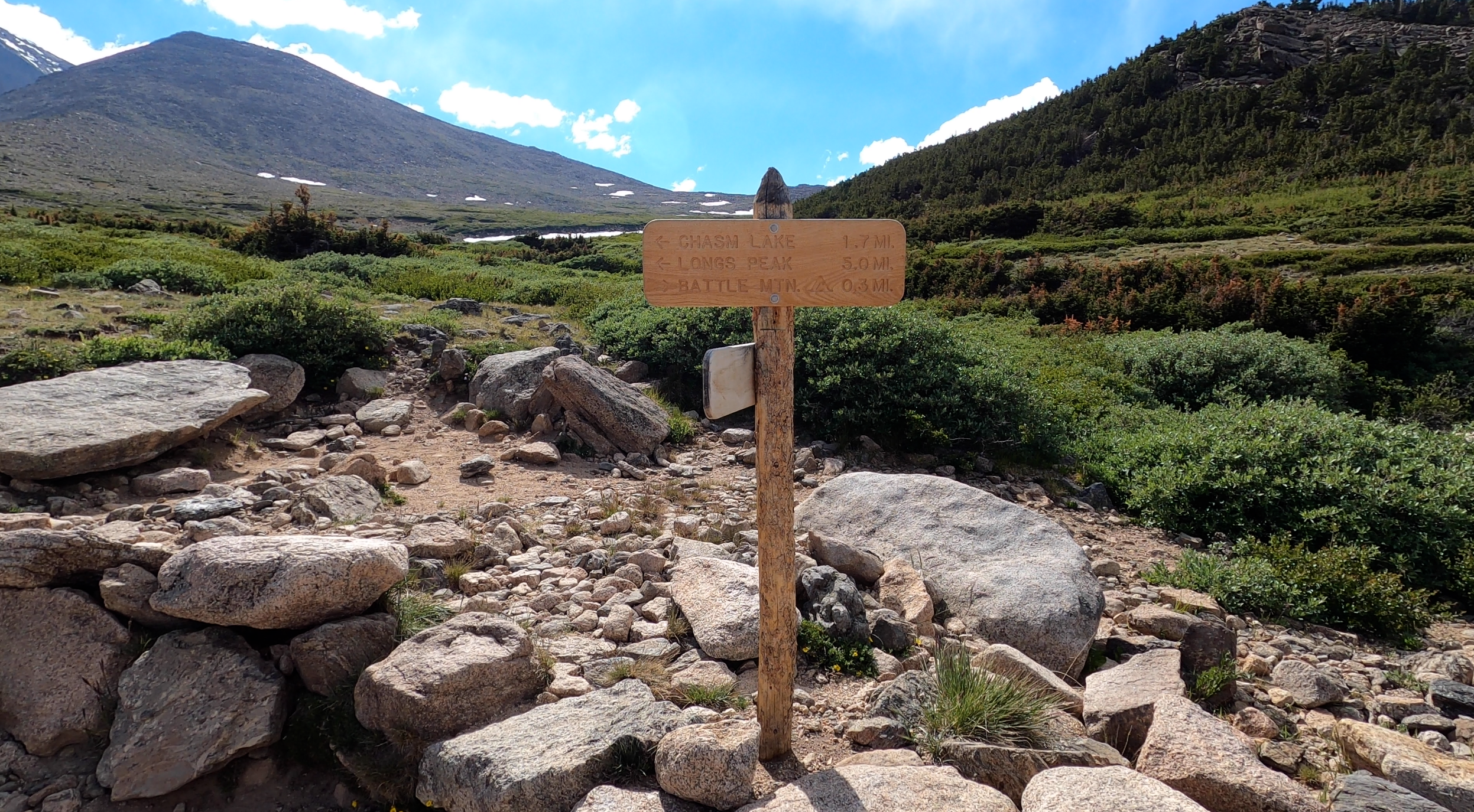
Ever more motivated I trudged on, passing a sign that read 1.7 miles to Boulder field- which finally felt attainable. As I made my way up the switchbacks I was greeted by a large family of Elk. They were munching on the grass under a beautiful skyline as the sun began to ease in the sky.
Elk on the Trail
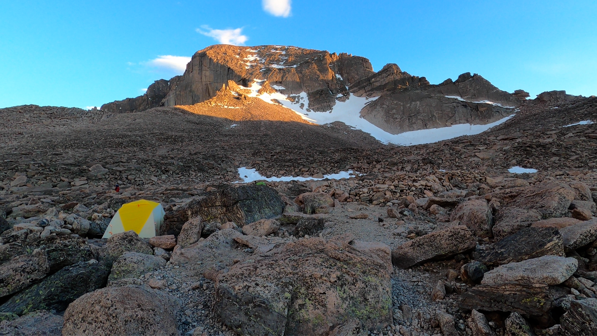
We greeted each other, recognizing that I was alone with just the animals now, was both a feeling of accomplishment and fear. I rose out of the switchbacks and into a giant field of rocks. This was the homestretch. Another 30 minutes and I arrived at a rocky field where the park service had built rock shelter walls for 9 different campsites. Just big enough for your tent the cozy little shelters were cleared of rocks on the ground and walled to keep wind and animals out. The campsite has two privies as well, but you must bring your own toilet paper. There was one other person at camp when I arrived at 8 pm, so it seemed I was not alone. I hurried to set up my tent before the sun set, and was able to have everything done and enjoying one of my PB & J’s as the sun turned the sky yellow, pink and red.
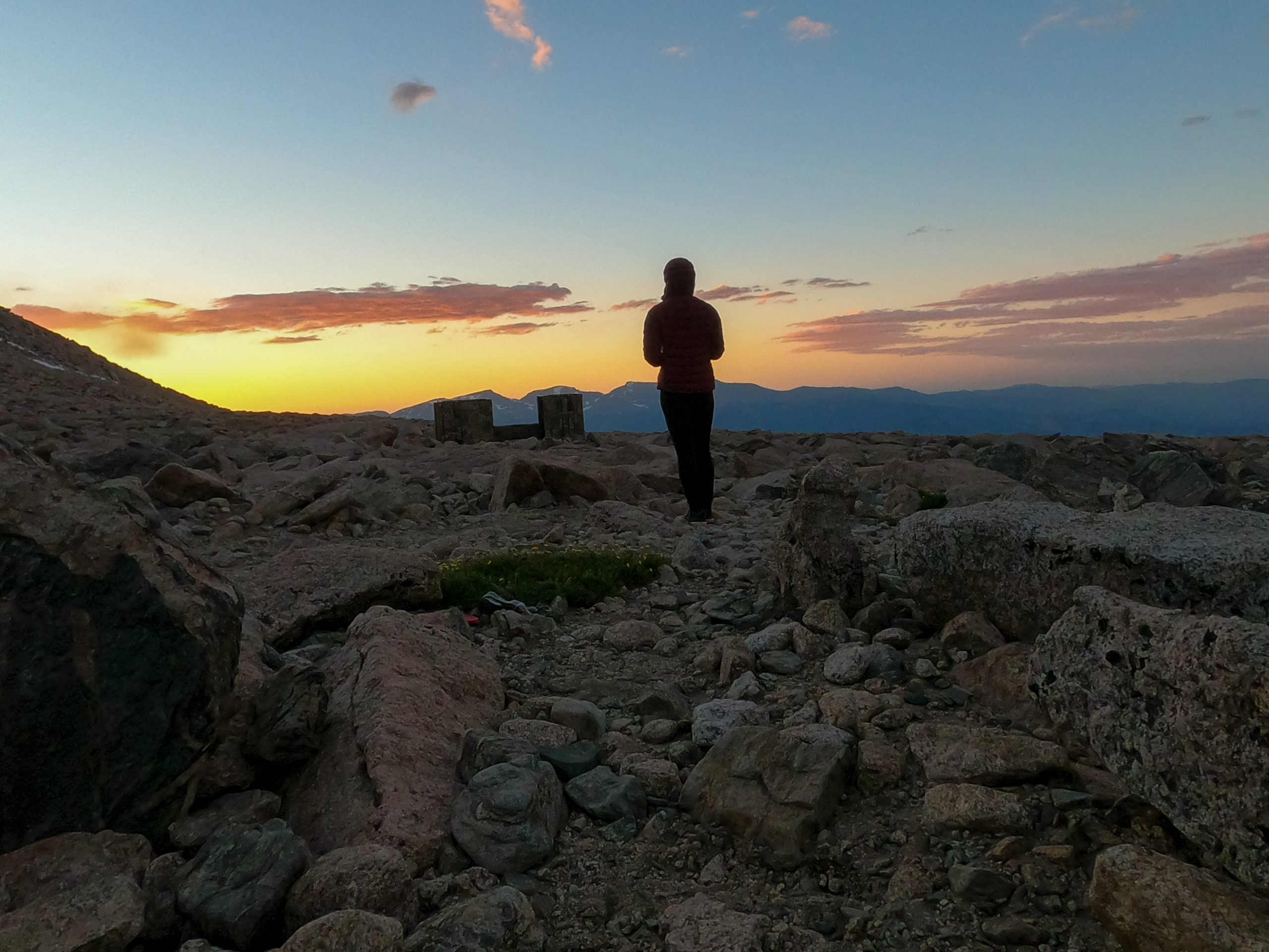
Proud of myself for pushing through I watched the sun go down and the full moon rise, and retired into my tent for an early night. I had hidden my bear box on the other side of the wall as advised by the park service, hopeful that no animals would bother me. I heard a few marmots from time to time but all in all, it was a very quiet night. Some other hikers came and set up camp around 11:30 pm and I heard their voices intermittently throughout the night. I woke often as I almost always do when camping, my body too cold, or too hot, or my arm asleep. I had neglected to bring my mattress pad, as I had no room left in my pack but regretted it as I tried to sleep on the cold ground.
Day Two: Attempting the Summit
Around 5:30 am I started to hear voices of hikers coming through the area and slowly started to stir. After a warm cup of coffee and some banana bread, I readied myself for the day’s climb. I took as much as possible out of my bag, so that I could be light and agile on the difficult trail ahead. The sun was just coming up and about to warm the peak from the cold night.
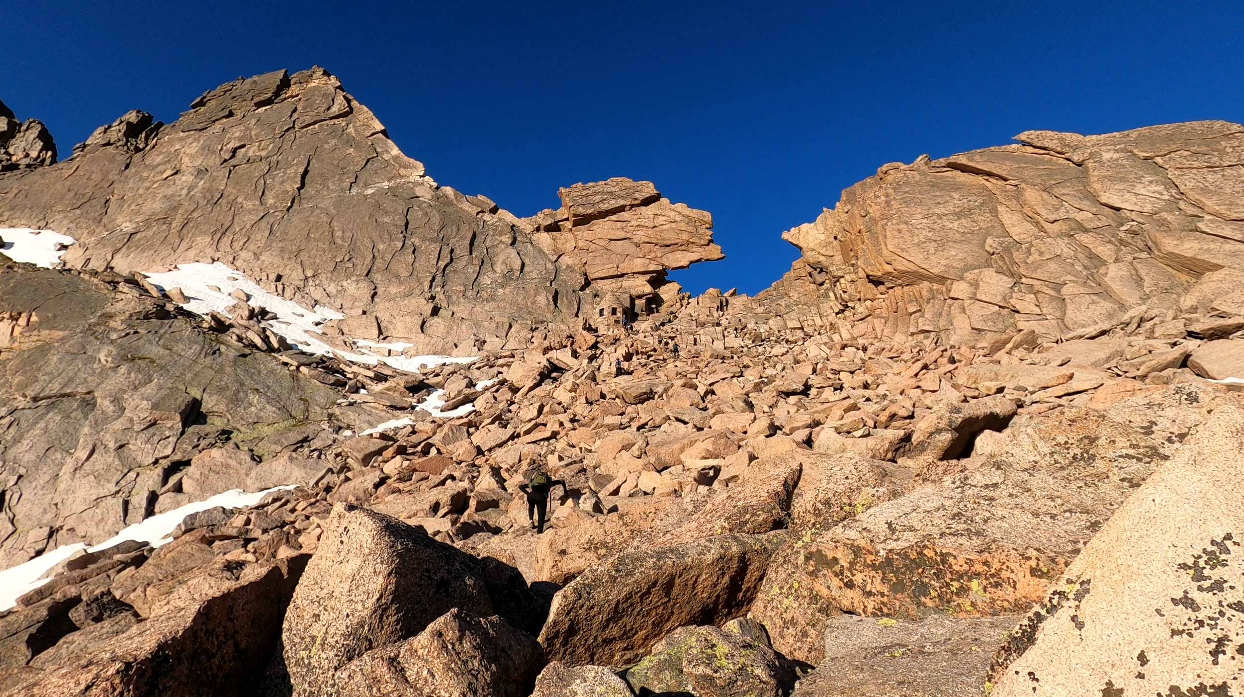
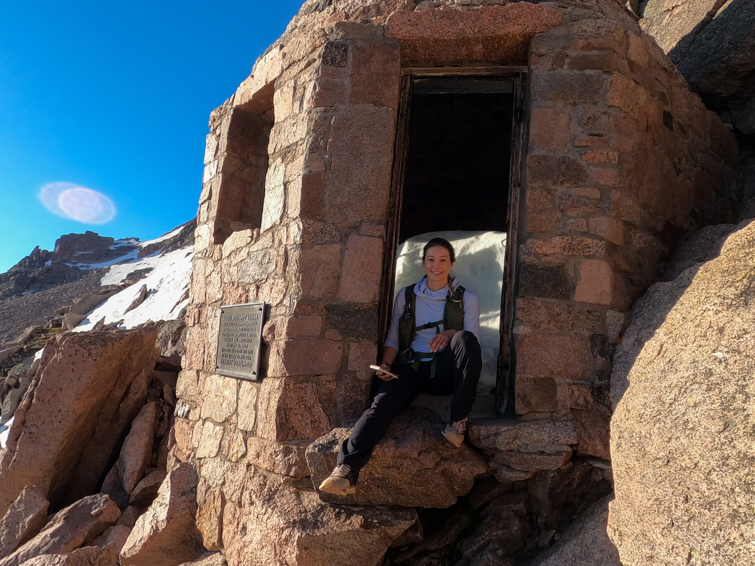
The trail is no longer a trail at all when you leave the Boulderfield and head towards the keyhole. I walked slowly from big rock to big rock following the rock pilings up the steep ascent towards the keyhole. The ascent to the summit on the keyhole route has three sections from the Boulderfield, the first is called the Keyhole, a light scramble that really warms you up for what’s to come. I honestly had no idea what to expect on these three sections of trail. Passing a mountain retreat that has been built into the wall of the mountain I entered the keyhole.
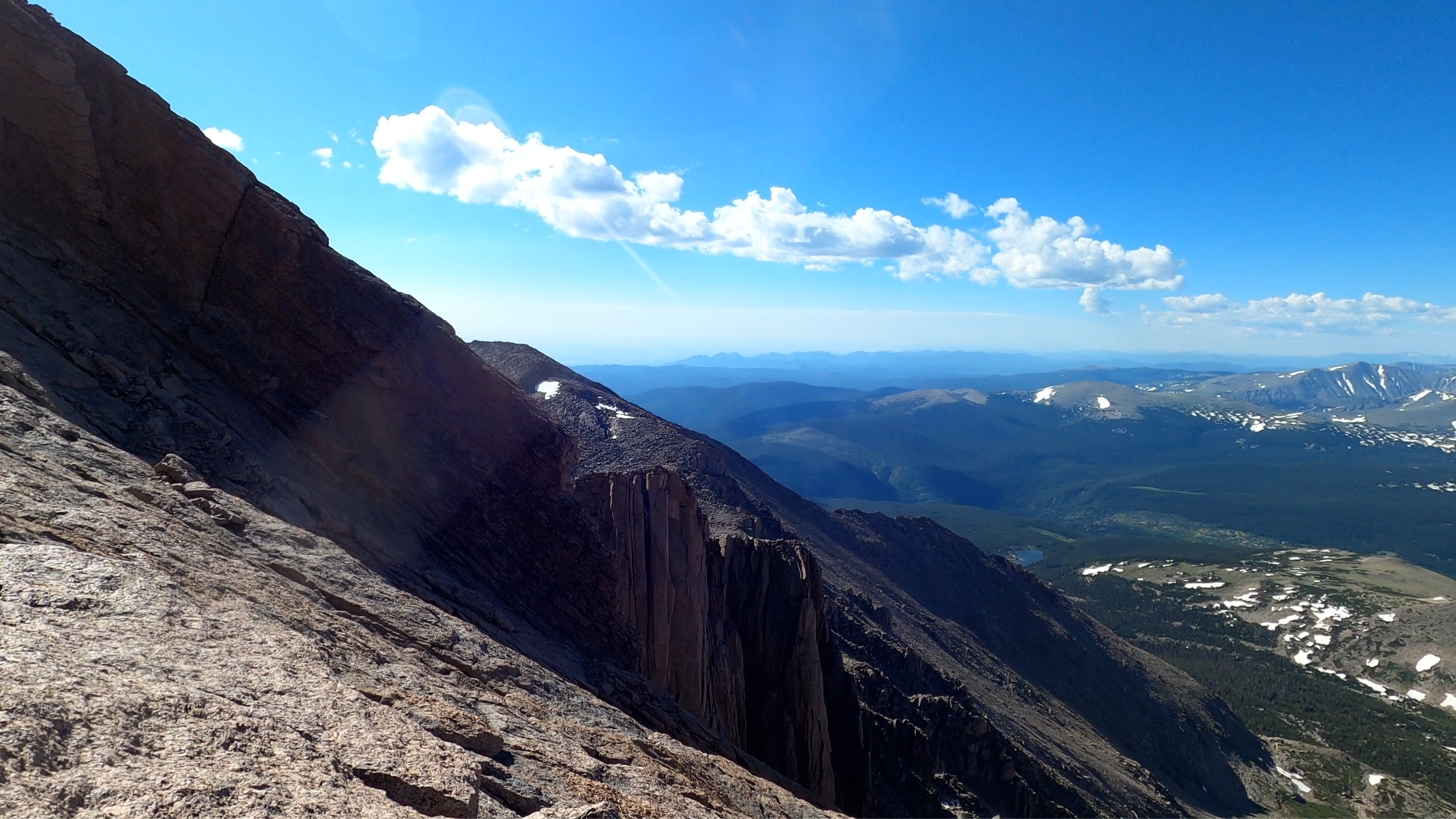
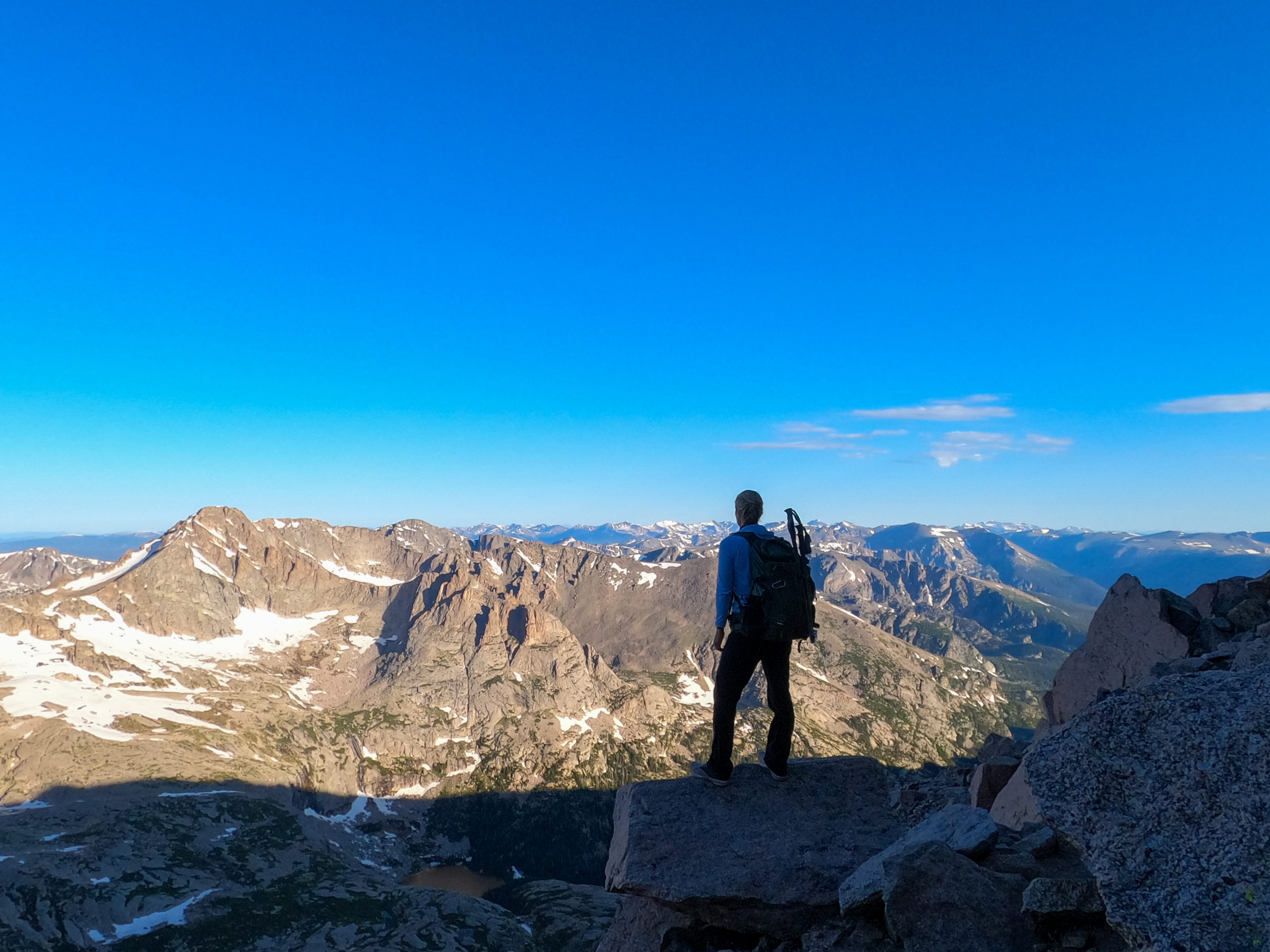
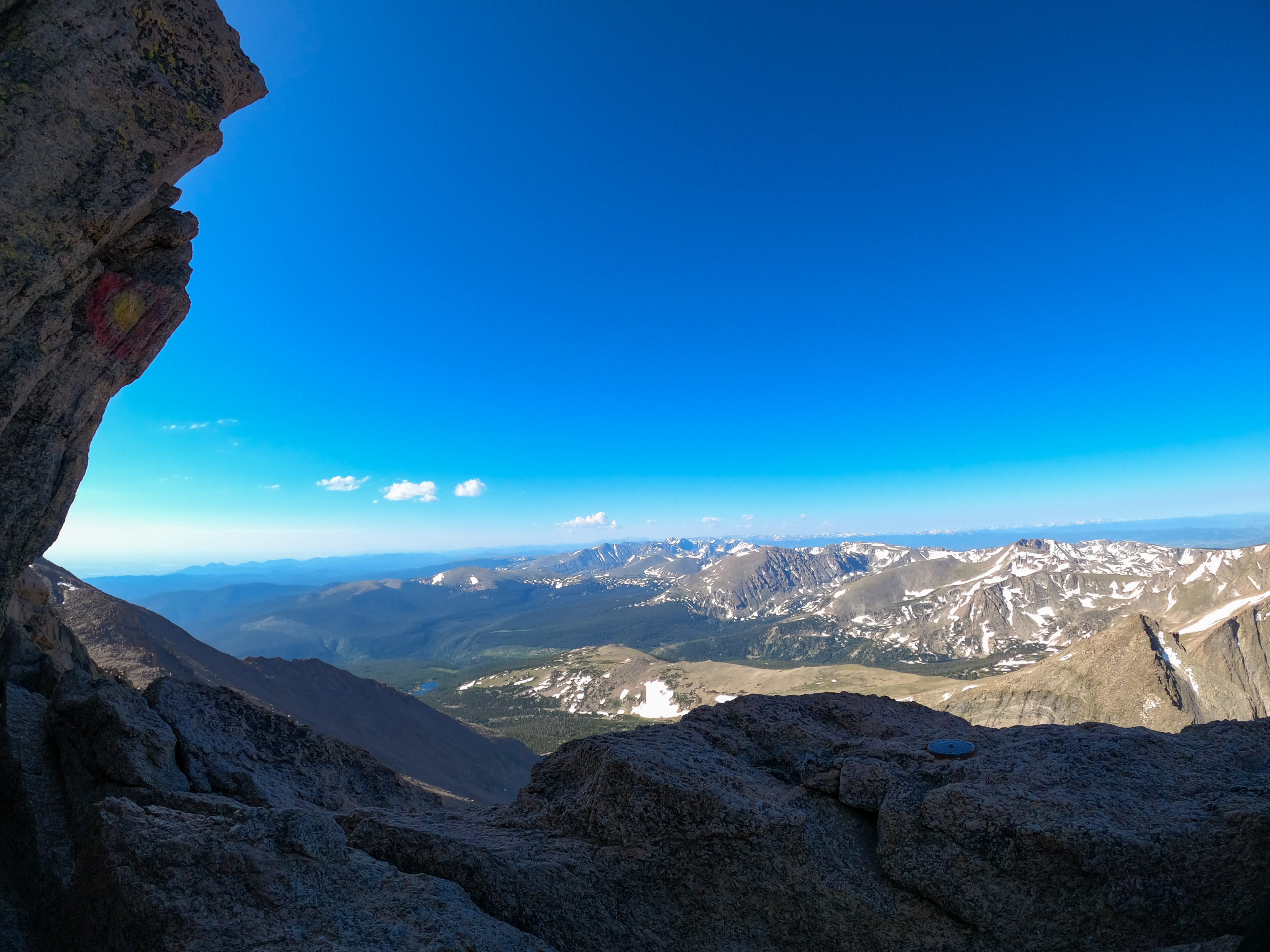
A beautiful formation of rock that has two overhangs that come together almost like a keyhole. From here the trail gets narrow as it comes onto the backside of the mountain. With ledge on one side and wall on the other, the area is rocky and winding but can for the most part be walked on upright. The views into the park from this side of the mountain are outstanding and hard not to get mesmerized in. After stopping to take a few pictures I came to a narrow area that required reaching out for handholds and scrambling through a narrow gap. As I leaned forward to grasp, my cell phone slipped out of its front pocket on my pack and I watched it as it slowly tumbled down the mountain. Falling about 75 feet, or so I thought, “Oh-Crap number 4!”.
Torn between going forward or going back I decided it was an area I may be able to reach and turned back to look for it, before continuing on. After several minutes of climbing and searching, I was stumped as to where the tumbling had stopped and decided to give up on my phone and head towards the summit. I told myself, a few photos and videos lost were better than my life, I would borrow a phone from someone to check in with my boyfriend before our agreed upon time at 4pm.
From this point the trail gets really interesting, ascending up and over rocks not meant for walking. This area is called the trough and it really is a steep, almost vertical trough of rocks. This area took quite a long time. A pitch of about 65 degrees combined with the rising altitude and the trickle of people coming and going made for a challenge. When I finally reached the top of this area with a few other hikers I was mystified and terrified by seeing the tiny prominence we sat at.
Thousands of feet down on both sides and nowhere to go! Well, there was a way to go, albeit small and narrow. And this is where the section called the narrows begins. Part of me wondered how a trail like this was legal, and the other part asked whether or not I should keep hiking. Encouraged by others around me, I swallowed my fear and continued very slowly making sure to keep my focus on the wall and not the cliff that dropped off steeply on the right. I had many moments of terror as I continued slowly along this narrow section that is devoid of ropes or other safety equipment. The last section of the narrows is an almost 80-degree pitch that looks more like it should be rock climbed with ropes than scaled sans equipment.
I sat at the bottom of this section for a few minutes, unsure if I should continue at all. Several passing hikers encouraged me and said the worst is over and the views are stunning, you can’t turn back now. Slowly but surely I crawled my way up this section of rock, making sure to only concentrate on where my hands and feet were going and not on what lay behind or below me.
As my hand made its last reach to the flat summit, my fear and anxiety were replaced with relief, and an utter sense of accomplishment. 14,259 feet! I was at the summit of Longs Peak- quite possibly the most difficult of the 14’ers in the state of Colorado.
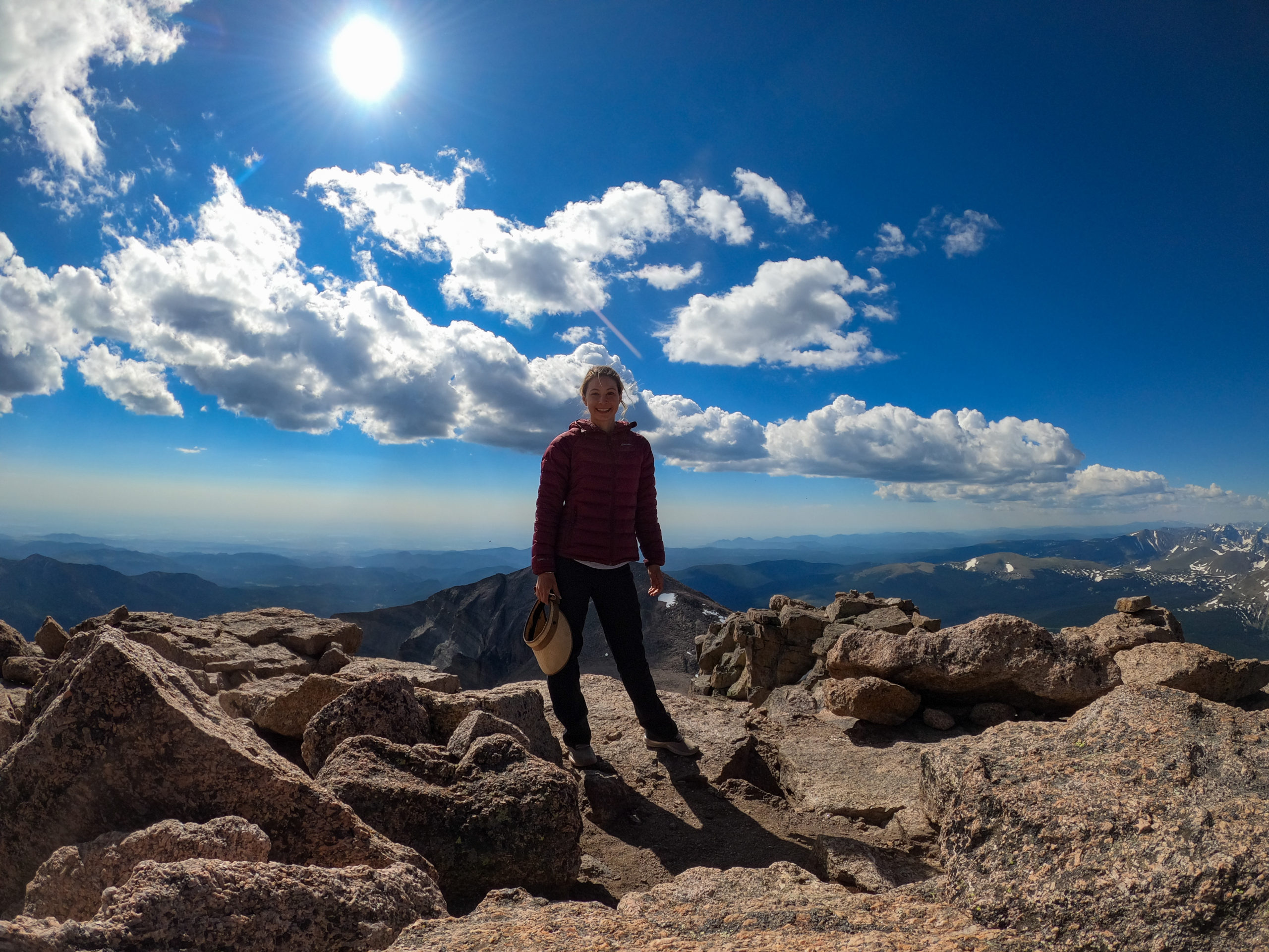
Reaching Long Peaks Summit
As I stood at the summit, looking out over Rocky Mountain National Park in all directions I thought of my dad, wishing he was still with me to share in this moment. He had died one week before my 30th birthday, and I had committed to myself to attack life differently after that. My ability to fight fear and push through the difficulty of my mind and body had been instilled in me from him. A true mountain man, whenever I want to feel his spirit, I head to the highest peaks I can find.
I stayed at the summit just long enough to call my boyfriend, have a sandwich, make friends with a marmot, and then it was time to face fear again. The mountain wasn’t done with me yet. The hike down through the narrows and the trough was quite possibly scarier than the way up, having to slide, scale and crawl down the slick rock and forced to look out over the ledge thousands of feet above the ground. I was so thankful for the other hikers and climbers that become instant family when on a mountain like this, I was encouraged, comforted, and inspired to continue even at my most fearful moments. After returning to the Boulderfield I packed up my camp, shouldered my heavy pack and began the long descent to the parking lot. I was smelly, thirsty, tired and devoid of a phone but none of that mattered much after completing Longs Peak. The path down passed by much more quickly than the way up. I said my farewell to a few marmots, elk and squirrels, making it back to my car at 2:30 PM, just missing the oncoming rain.



Wow this hike looks amazing! I’m a sucker for stunning views and this one takes the cake. I love the additional snow-capped moutain peaks, and the sunset looks amazing!
It’s very brave of you to tackle this hike on your own… With 30 pounds on your back! I hated carrying a heavy backpack when I travelled… I would need some serious training before I embark on something like this… Keep up the videos!
What a sense of accomplishment- giving you such resilience to do anything you set your mind to. Courage, strength, determination and being solo! That’s awesome. I’m sure your dad was with you every step of the way.
Wow what an adventure! The best thing was that even with challenges, you didn’t give up. It must have been quite tough carrying everything in your backpack. It was interesting to learn about how they are managing visitors during the pandemic.
OMG you backpacked to Kilimanjaro? That’s so cool! When we were teenagers we joked that we would go to Kilimanjaro someday. Well.. never made it and with my back problems I guess it’s for another lifetime! The Rocky Mountains look fantastic too. Would love to see parts of it (without hiking too much?) someday!
:). The rockies are amazing, even if you don’t hike. The summer and fall are my favorite seasons .There are also amazing hot springs you can visit. I recommend a roadtrip through Ouray, Pagosa Springs, Santa fe and then back up through CO.