Goat Canyon Trestle Hike: What to Know Before You Go
The world’s largest wooden trestle bridge is located deep in the southern deserts of Southern California’s Anza Borrego Desert State Park. Located just 15 miles from the border with Mexico, don’t let this hike deceive you—it’s hard, despite being just 6 miles long, and should never be attempted when the temperatures are over 80 degrees.
Before you set out for a Goat Canyon Trestle hike, you need to prioritize careful planning and research. Get a reliable GPS with a downloaded map, take a four-wheel drive vehicle with high clearance, and be sure to bring plenty of water, sun protection, and some serious mental fortitude. You will hike what feels like not one mountain, but two! You’ll scramble, climb, and slide over rocks, gravel, and sand, all while avoiding prickly cacti and thorn-covered bushes.
This is one of the more brutal short hikes I’ve done in a long time, and that’s saying something—I hike a lot. I can’t emphasize this enough: Do not attempt this hike if you are not experienced at route finding and have not done your research.
If you think this hike sounds like an exhilarating challenge and are still keen to experience the Goat Canyon Trestle hike, read on for the details!
This challenging hike is one of the most rewarding in California, but be sure to arrive prepared for it! Disclosure: This post may contain affiliate links. If you decide to make a purchase through them, I may earn a small commission at no cost to you. Thank you for your support!
Doing the Goat Canyon Trestle Hike Via Mortero Palms Trail
- Trail length: 7.2 or 5.8 miles, depending on where you start
- Time on trail: Around 6 hours
- Elevation: 2500’ of elevation changes; lots of class 2 and 3 scrambling. You will ascend steadily for the first 3/4 of the hike, then descend the last mile, which must be hiked in reverse. Some sections would be deadly in low light.
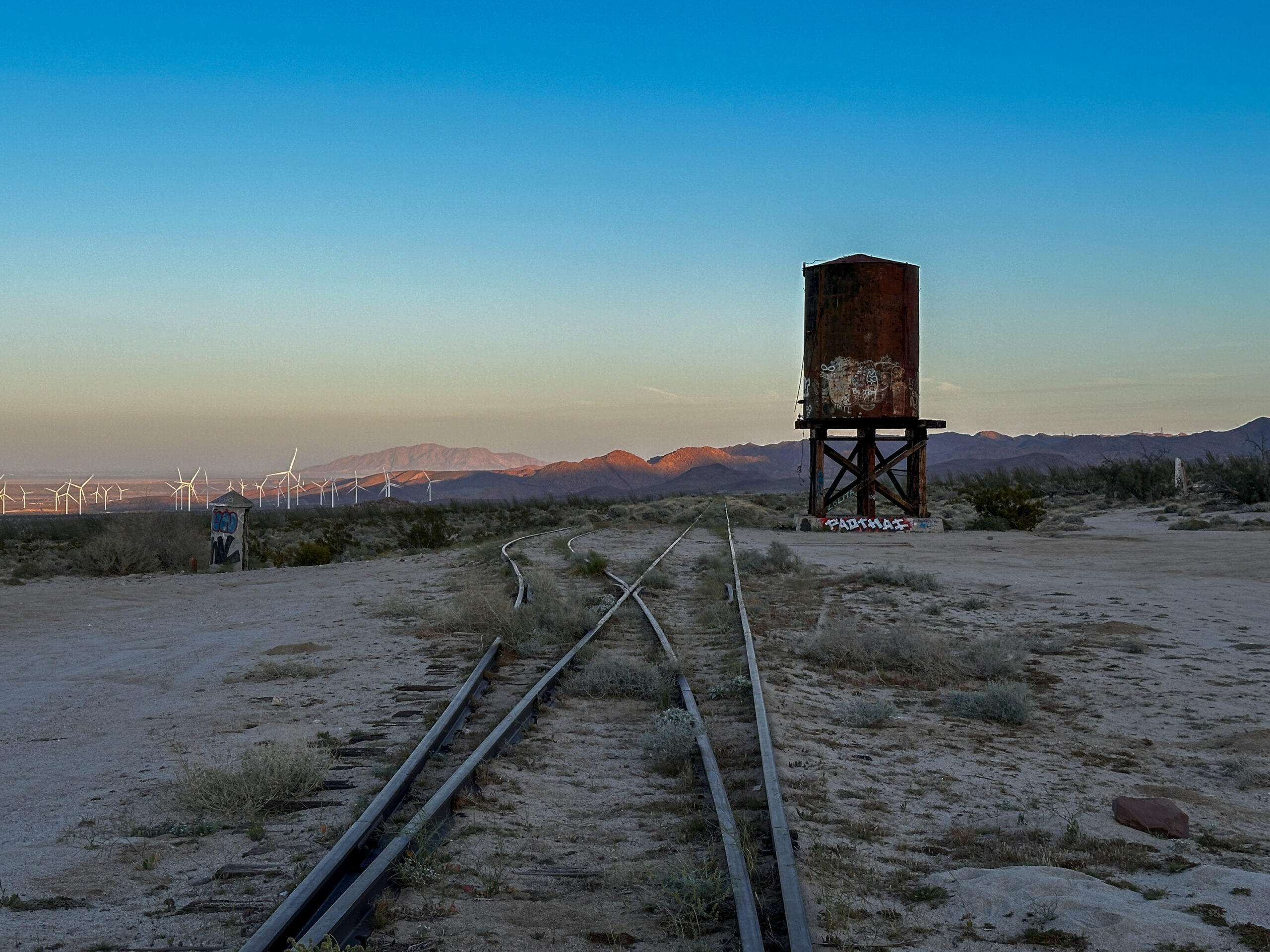
Be aware that Google Maps might tell you to cross the train tracks in the wrong spot. The best place to cross them is closer to the water tank, which you should see on the left-hand side when coming across the tracks as referenced in the video below. In this section, the wooden boards are higher than the tracks, allowing you to cross in a better spot than the alternate road.
There is an alternate longer route to get the bridge which can be hiked or biked at around 16 miles. More trail information is here. Gear you’ll need includes a sun hoodie or moisture wicking shirt, long pants for combatting sharp bushes and thorns, water bladder or bottles that hold 3 liters of water, a hat, sunglasses, sunscreen, and a downloaded map from Alltrails or On X Offroad.
Pay attention to drone rules in the park—drones are not allowed to fly over any parts of the Colorado desert. Other things to note: There is no shade or water on the trail. Bring three liters of water at minimum, as you won’t be able to refill. You will need a four-wheel drive vehicle to get to the trailhead. High winds are often present at the bridge and along the trail.
Helpful Tips for the Goat Canyon Trestle Hike
If you are starting the Goat Canyon Trestle hike from the far parking lot, you will start in a wash and need to find the trail. It should be off to the right and marked with one or two stacked stones every few hundred feet, so keep your eyes peeled as you make your way toward the trail this way.
Following the footsteps in the sandy wash will often lead you off the trail and require you to scramble and climb more than is necessary. Try to pay close attention to all trail markers and map points—this is why I recommend downloading your map in advance!
It is important to download a trail map before you go as there is little to no service near the trailhead and along the route. I downloaded this map on All Trails to follow along on the hike. It’s critical to make sure your map is available for offline use.
- Do not attempt to reach the trailhead without a high-clearance, 4X4 vehicle.
- Do not attempt to hike this trail in the dark.
- Do not attempt this hike in summer when temperatures are over 80F.
Getting to the Goat Canyon Trestle Hike
From San Diego, drive along Highway 8 toward the very small town of Ocotillo. There will not be much of anything to buy or eat once you leave greater San Diego, so be sure to stock up with water, snacks, and supplies before you leave home.
There is an unmarked road that you will turn on that takes you to the Dos Cabezas train station. This is a favorite road for off-road vehicles and is part of the Anza Borrego State Park. I would highly recommend downloading this area of the state as an offline map so you can navigate; there are many dirt roads and you may get turned around on your return trip. Most of the drive along these six miles or so is just dirt, but there is some tricky grade and two spots where you will certainly need four-wheel drive.
I neglected to take a photo of the one large rock outcropping, but you will know it when you see it. Drive slightly past it, then reverse with your left hand down until you are facing it from the high side—then it’s an easy drive over it. If you attempt to drive straight over from the roadside at a straight angle, you will most likely scrape your undercarriage.
Once you pass this obstacle it’s another mile or so to the trail.
The Goat Canyon Trestle Trail
I started this trail around 1:00p.m.—way too late in the day, and don’t make the same mistake I did! It was tough to finish before dark, especially since I wanted to linger and explore at the bridge.
The trail begins in an unmarked parking lot and is mostly flat for a bit. I missed the cairns for the first mile or so and followed footsteps in the wash, which were not actually on the trail. There is a trail off to the right of the wash that follows the same route, but eliminates a little bit of the scrambling. Look for small cairns and check your map often.
The trail is exposed and full of sand and gravel, making for a slow pace. If you find the trail, you will go through lots of thorny bushes and past an old cow trough left from decades past when cattle grazed in the area.
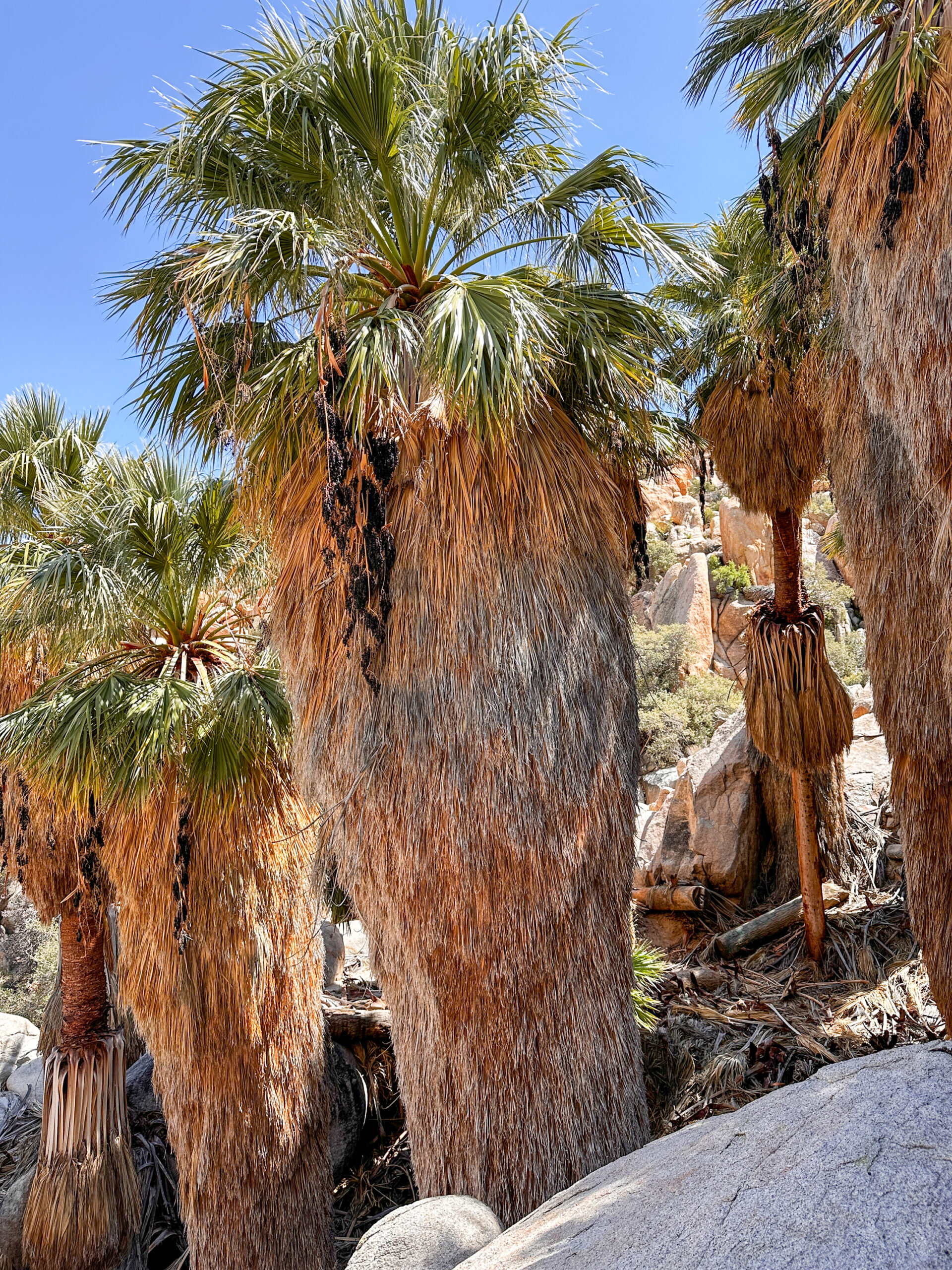
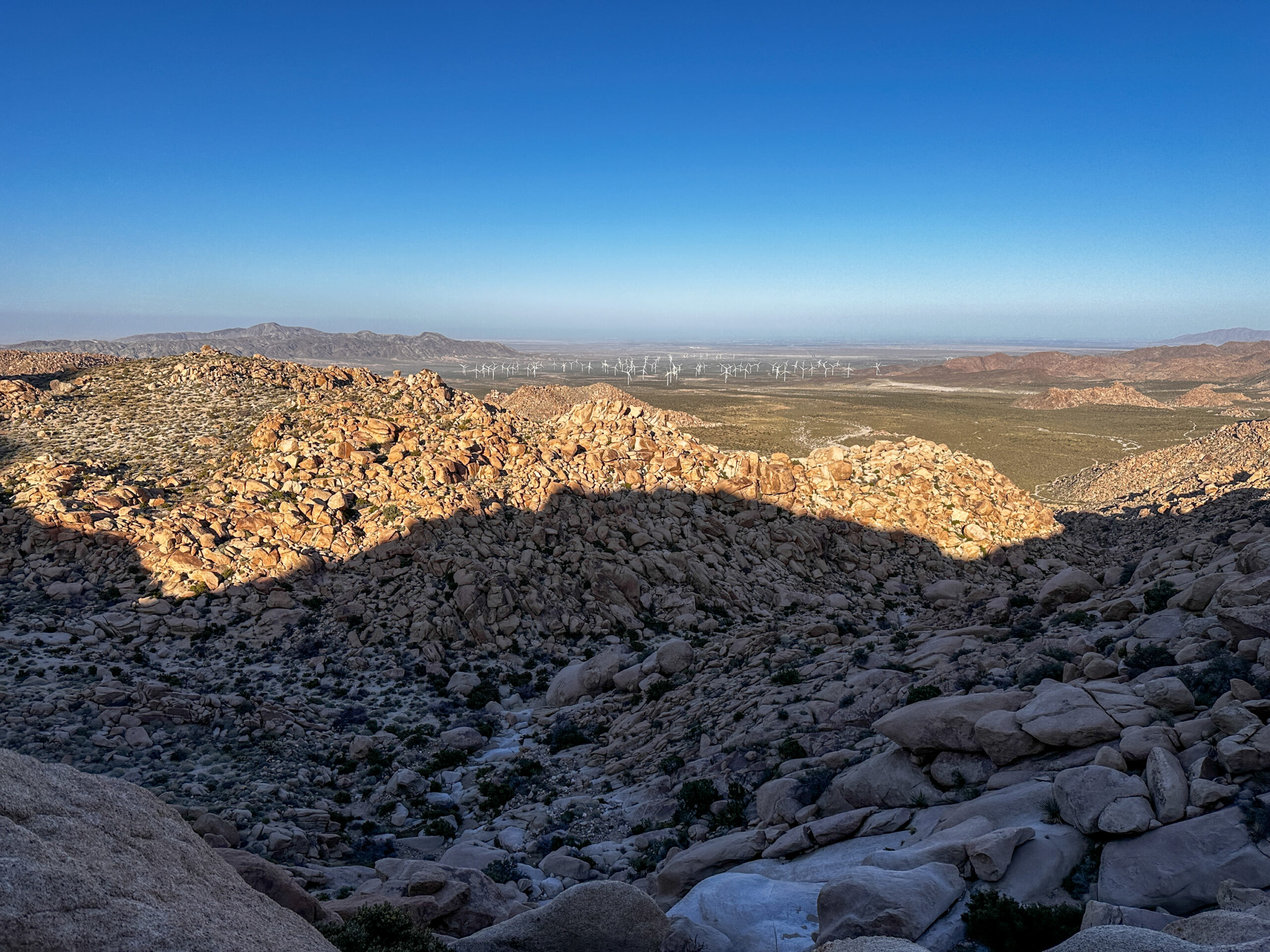
Two paths can be taken on the Goat Canyon Trestle hike; I ended up going through a palm tree oasis, which required some class 2 and 3 scrambling up and over large boulders along with some narrow and steep rock outcroppings.
After this initial steep section, the trail levels again, but not for long. You will soon find yourself ascending for quite a while. This trail (which would be on the south or left side of your map) goes up a steep section of smooth rock, where route finding can be difficult. It’s steep with dangerous drop-offs, so go slowly and pay attention for cairns or spray paint that show the correct position.
After this section, the trail is more easily visible. After ascending a bit more, it levels out for a short while. The trail then steeply descends for around 1 mile towards the bridge itself. This section of the hike is incredibly steep and you will need to pay close attention to find the best possible route down. There are small cairns every so often that will help, but go slowly and look around for guidance.
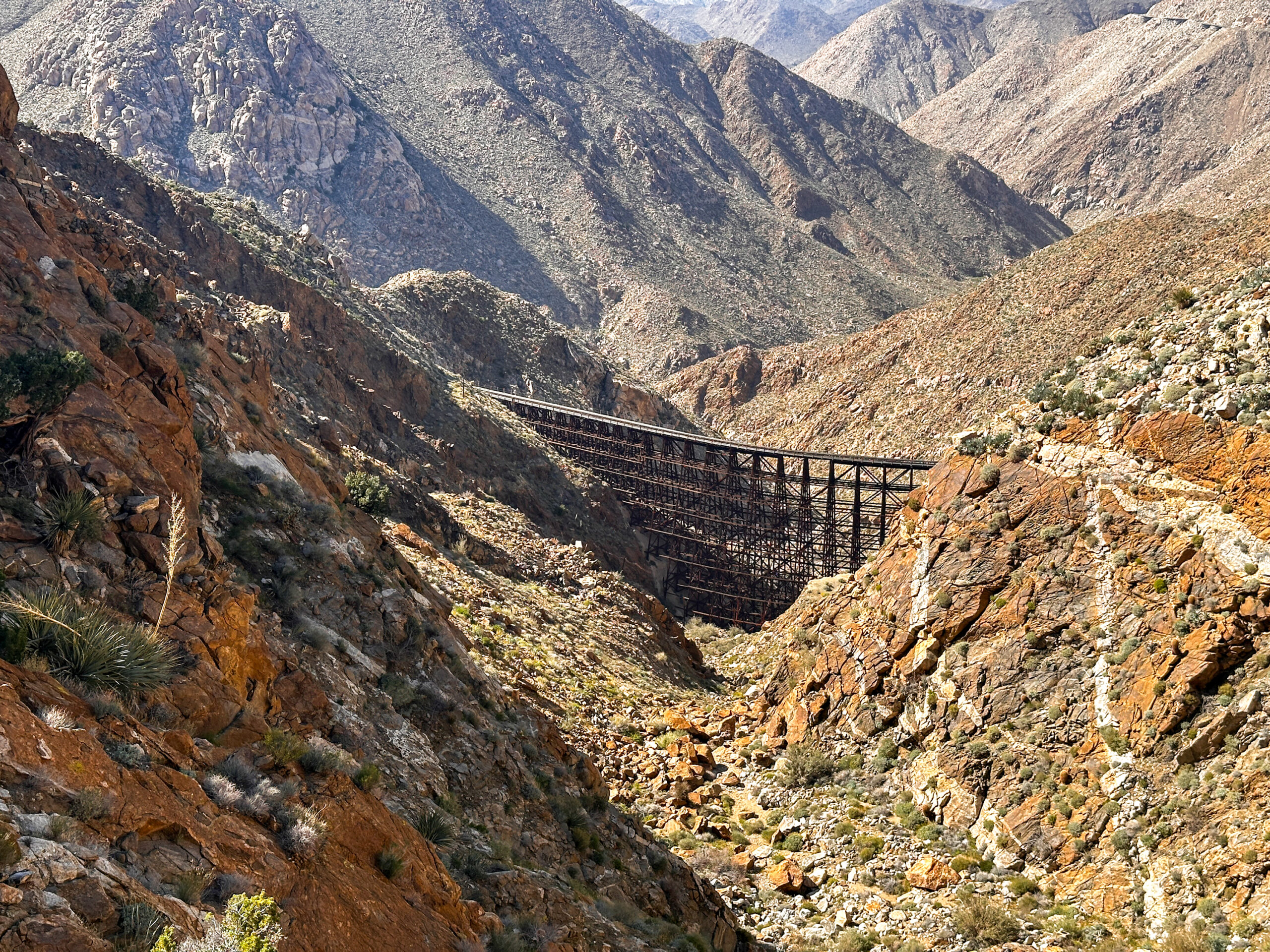
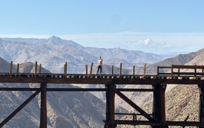
Halfway down this section, you will see the railroad tracks and the bridge come into view. Once you arrive at the trestle, you can relax for a few and look around at the old train car, the collapsed tunnel, and walk on the bridge—if you so dare. I found it to be rather sketchy and somewhat falling apart. I would recommend walking closer to the metal ties if you do decide to go across.
Because I started this hike so late in the day, I had very little time to explore. So after snapping a few photos and having a quick snack, I threw my pack back on and made the arduous ascent back up the canyon so I could make it back to the car before dark.
History of Goat Canyon Trestle
Goat Canyon Trestle was built in 1933 as part of the San Diego and Arizona Eastern Railways. It was built after one of the many tunnels on the railway collapsed. The railway itself was called the “Impossible Railroad.” Upon its completion in 1919, it ran through Baja California and Eastern San Diego before ending in the Imperial Valley. Passenger service once went over the bridge, but stopped in 1951 when automobile travel increased.
The railway was used for close to a century, but has not seen railcars over its tracks since around 2008. This railroad experienced a series of difficulties and many thought it would never be completed. It closed often due to collapsed tunnels and rock slides—one of which called for the building of the Goat Canyon Trestle.
Amazingly, the bridge was built of wood and without nails, as temperature fluctuations made metal or steel unsuitable. The trestle was also built with a 14-degree curve to combat the high winds the area often sees.
In 2018, the Baja California Railway assessed the line in hopes of repairing several tunnels and bridges and returning service across the bridge. But as of 2021, these plans have been abandoned.
Is the Goat Canyon Trestle Hike Worth It?
The Goat Canyon Trestle hike is definitely worth the adventure, as long as you’re well-prepared for the unique challenges that come with the landscape and know what to expect. It requires a higher degree of fitness, trailfinding ability, and plenty of rock scrambling. Make sure you have a vehicle with four-wheel drive to access the trail, an off-line GPS downloaded map, and bring plenty of water. Don’t plan on doing this hike during the summer months—the heat will be too much to handle with no shade.
If you want to see more of the Anza Borrego Desert State Park, check out some videos from America’s largest state park!




0 Comments