Best National Park Hikes in California: Epic Scenery & Adventure
Psst: When you visit California’s national parks, please take care to follow all park rules, keep your distance from wildlife, and leave only footprints. This post contains affiliate links. If you make a purchase through them, I may receive a small commission (for which I am deeply grateful) at no cost to you.
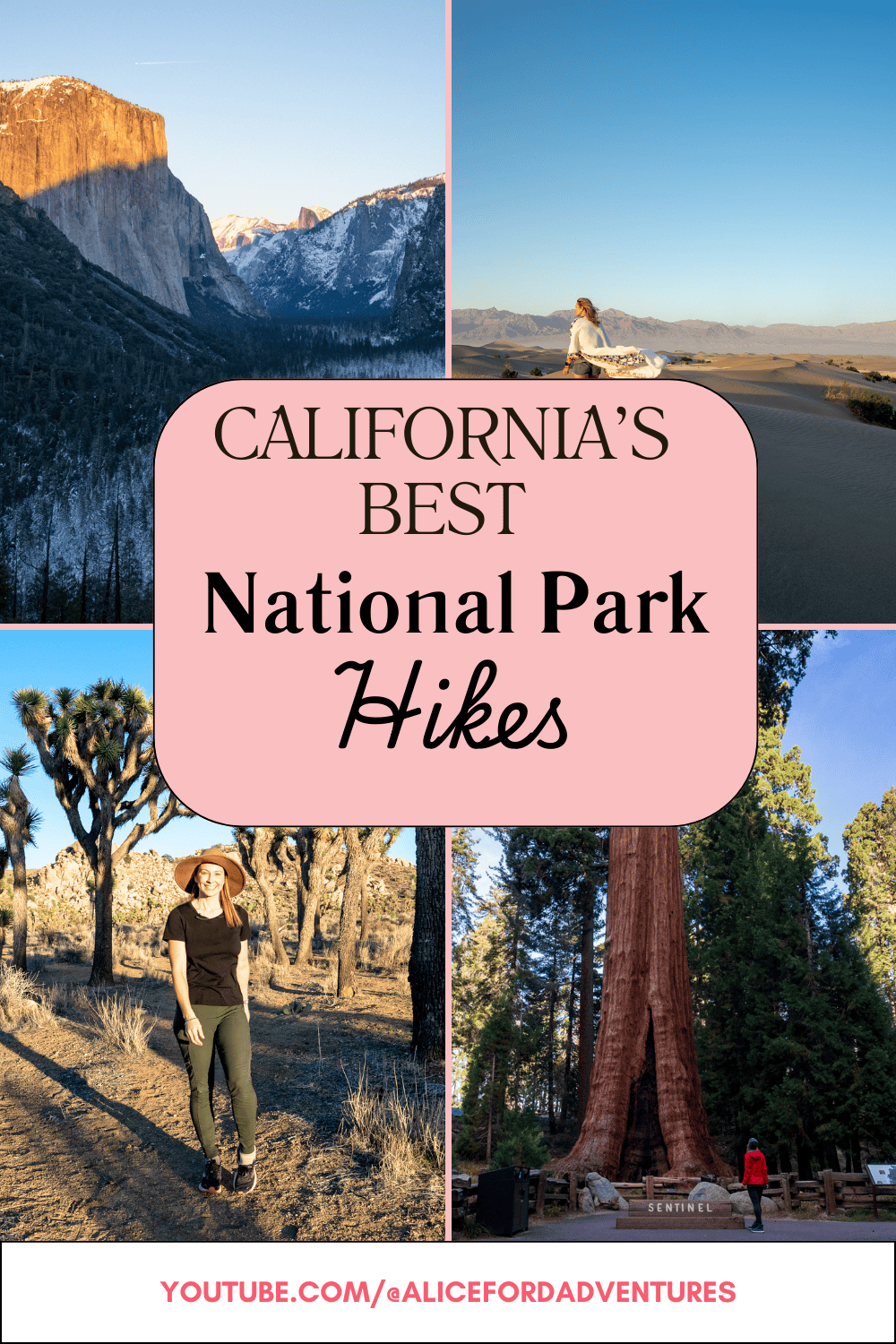
Looking for the top trails that showcase California’s rugged beauty and natural wonders? From waterfalls and alpine lakes to volcanoes and hot springs, the best national park hikes in California are the perfect chance to escape into the wilderness for a little while.
California is home to the most national parks in the U.S. and these vast, scenic wonderlands are where you’ll find some of the state’s best hiking trails. All 9 of California’s national parks have amazing trails:
- Yosemite National Park
- Lassen Volcanic National Park
- Sequoia National Park
- Kings Canyon National Park
- Redwood National Park
- Joshua Tree National Park
- Channel Islands National Park
- Death Valley National Park
- Pinnacles National Park
The 19 hand-picked trails below showcase the state’s most jaw-dropping scenery, wildlife, and panoramic views on trails that range from easy to seriously challenging. Ready to get your feet moving? Start with the best national park hikes in California!
Don’t forget to grab a National Park Pass before you hit the road.
Best Yosemite National Park Hikes
- Best time to visit: Mid to late spring
- Requirements: Entrance pass; reservations (Apr-Oct); permits (Half Dome)
Yosemite National Park is synonymous with California’s beautiful wilderness: waterfalls, amazing rock formations like El Capitan and Half Dome, idyllic meadows, and groves of giant sequoias. It makes sense that this World Heritage Site and national park is home to some of California’s best hikes!
Mist Trail to Vernal Falls (Moderate)
The signature Yosemite trail leads 5.7 miles & 1,000’ up to Vernal Fall; continue on to Nevada Fall if you’re up for a steep challenge! Experience cliffside stairs, getting sprayed by the falls, and amazing views of the park on the way.
Download a trail map on AllTrails
Half Dome (Strenuous)
This is the trail to summit Yosemite’s most iconic rock formation and see what you’re made of. It’s one of the most epic hikes in California: 16+ miles (depending on the trailhead you start from), 4,800’ of elevation gain, and 10-14 hours of hiking!
You’ll need to grab a highly-coveted permit for the cable ascent section, but scoring these permits is basically a competitive sport. Day hikers go through a lottery process to get permits, while backpacking permits can be added to your wilderness permit and are limited to 75/day.
If you do manage to snag a permit don’t forget a pair of gloves and a harness and lanyard to clip into the cables if you’re afraid of heights. Here are some safety items I reccomend for this hike.
Artist Point (Easy/Moderate)
Short with a steep section, the scenery is insane on this 2-mile trail with vistas reminiscent of Tunnel View (without the crowds). You’ll see views of Clouds Rest, Bridalveil Meadow, Ribbon Fall, and North Dome on the trail!
Things to Consider
Entrance passes are required, and entrance reservations are required on some days from mid-April through October. Check requirements here.
Spring (April-June) is the best time for hiking Yosemite, thanks to pleasant temperatures, smaller crowds, peak runoff in May/June, and wildflowers dotting the landscapes with pops of color.
Best Lassen Volcanic National Park Hikes
- Best time to visit: Summer & fall
- Requirements: Entrance pass; camping permits
Lassen Volcanic National Park has an edge that other California NPs might lack — its otherworldly volcanic landscapes border on hellish at times, but with four types of volcanoes, bubbling mud pots, boiling pools, steam rising from fumaroles, and lava landscapes alongside beautiful waterfalls, streams, and rock formations, it’s an incredible hiking destination.
Bumpass Hell (Easy)
The scent of sulfur fills the air, but the sights of hot springs, mud pots, and fumaroles make it worth it! This is the largest hydrothermal area in the park, flowing with acidic streams that erode the rocks and add to the beautifully strange landscape.
This 2.7-mile trail is neither long nor strenuous, making it a great option to take in some cool scenery without exhausting yourself. It’s likely to become your favorite trail in the park!
Lassen Peak (Strenuous)
Lassen Peak is the world’s largest plug dome volcano, and the 5-mile hike to the summit is a memorable one that ranks as one of the best in California. It’s a relatively short trail, but very steep, so plan on about 4 hours to finish this hike atop an active volcano.
You’ll feel the burn (no pun intended) with 2,000’ of elevation gain leading to incredible views.
Kings Creek Falls (Moderate)
This is one of the most popular hikes in Lassen, leading 2.8 miles down a rugged and scenic trail through wildflower meadows and fallen logs to reach the 40’ Kings Creek Falls. The cascading falls are gorgeous and feel nice and cool on a hot summer or early fall day.
Things to Consider
Lassen entrance passes are $10-$30, depending on the season. You’ll only need a permit if you’ll be backcountry camping in the park.
July through September/early October is the best time to visit for hiking, but crowds, wildfire smoke, and early snowfall can be issues.
Best Sequoia/Kings Canyon National Park Hikes
- Best time to visit: Summer & early fall
- Requirements: Entrance pass; cave permits
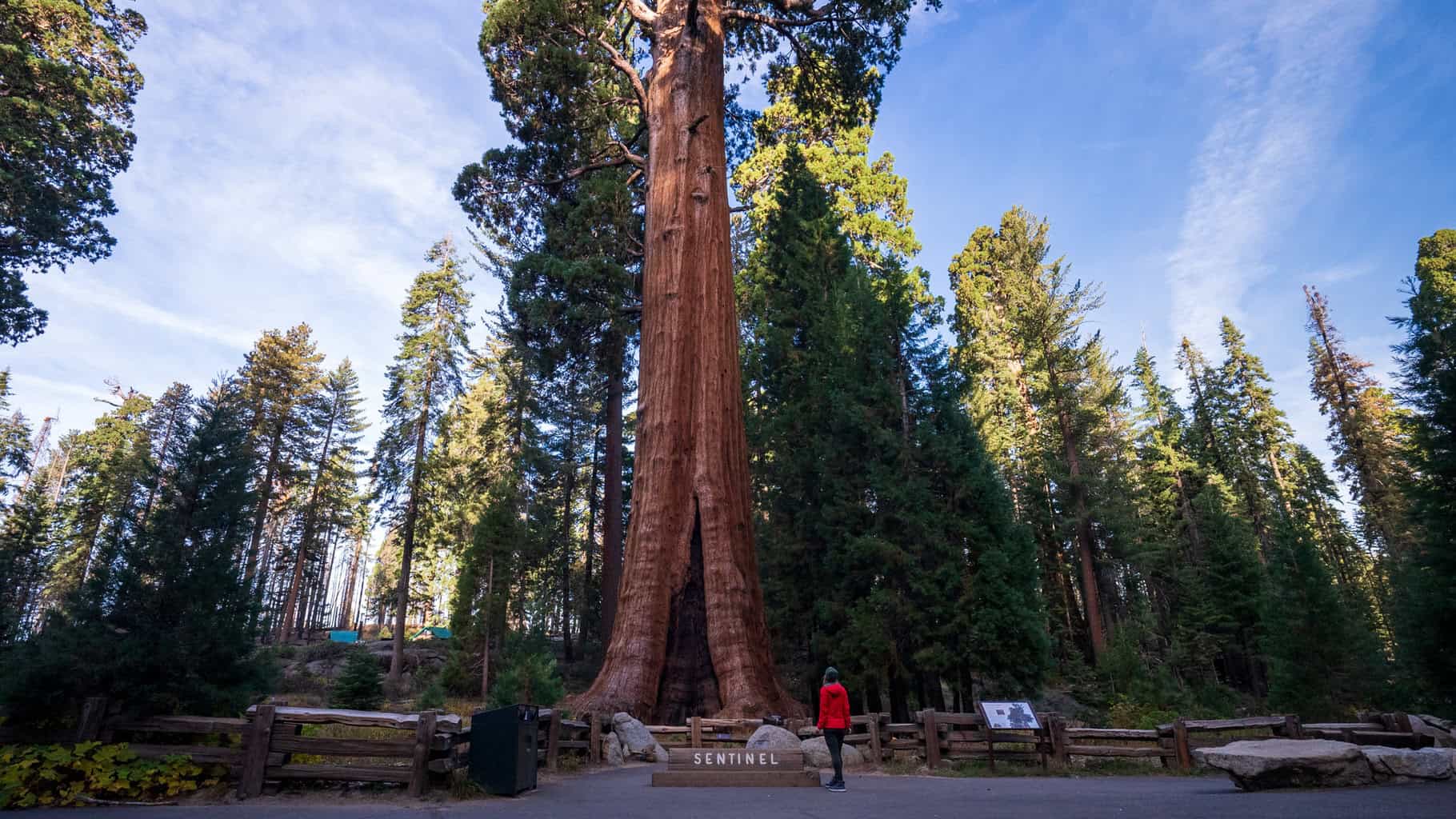
Sequoia & Kings Canyon national parks are sister parks, located very close together in the Eastern Sierras. Giant sequoia trees stand in dense groves, rivers slice through rocky canyons, and miles of marble caverns open up from the ground in these forested oases. The drive between the parks is like a destination all on its own with beautiful views!
Moro Rock Trail (Moderate)
This is a short and steep ½ mile trail off Crescent Meadow Road. Ascend 400 stone stairs to the top of Moro Rock for unmatched views of the Giant Forest sequoias and surrounding landscapes.
General Sherman Tree Trail (Easy)
You can’t visit Sequoia without taking this quick and easy hike off Wolverton Road! It’s just 1.2 miles and brings you into a grove of sequoias to reach the famed General Sherman Tree. It towers 275’ tall and is 36’ wide.
Kings River Trail (Easy)
Take this secluded 3.5-mile RT trail along the banks of Kings River in Kings Canyon NP to reach the 40’ Roaring River Falls at Zumwalt Meadow. Breathtaking in springtime, this trail follows a lollipop loop shape with a very slight incline.
Things to Consider
Summer and early fall are ideal for hiking in either park with warm, dry weather, but summer crowds can be huge. Opt for May or early September to get the best of both worlds — smaller crowds with great hiking weather.
You won’t need a permit to hike, but you will for backcountry camping and exploring caves in the parks.
Best Redwood National Park Hikes
- Best time to visit: Spring & summer
- Requirements: Entrance pass; Fern Canyon parking reservation
Redwood National Park is unique because it’s actually several parks in one. RNP also includes Jedediah Smith, Del Norte Coast, and Prairie Creek state parks. Tall coastal redwoods create a dramatic landscape with dense, shady groves where the canopies tower overhead and make you feel very small.
The Howland Hill Scenic Drive through the park is fantastic, giving you a chance to drive between redwoods and see the beauty of this giant landscape. About 45% of the remaining coastal redwoods are protected here!
Stout Memorial Grove Trail (Easy)
This half-mile trail takes you alongside the Smith River where a giant grove of 300’ tall redwoods thrives and casts cool shadows on the ground through the high-up canopy. Access the parking lot from the eastern end of Howland Hill Road.
Fern Canyon Trail (Easy)
Just 1.1 miles, this trail is all about the scenery. You’ll descend 30’ down into a small canyon, walls lined with lush green ferns to create an almost magical vibe. Evergreen trees skirt the canyon and you’ll walk through a shallow creek to reach it, scrambling over mossy logs.
Make it a beautiful, heart-pumping hike that’s reminiscent of Endor by coming in on the 10-mile James Irvine Trail from the Prairie Creek Visitor Center (which also removes any parking reservation requirement).
Things to Consider
You will need to apply for and receive a free Fern Canyon/Gold Bluffs Beach parking reservation if you’re driving to Fern Canyon, but not if you’re hiking in from the Prairie Creek Visitor Center.
There is no entrance pass or fee required for the NP, but to get back to the park from Fern Canyon, you’ll have to pay $12 per vehicle at the station on Davison Road. Frontcountry and backcountry camping permits are required in advance on Recreation.gov.
Best Joshua Tree National Park Hikes
- Best time to visit: Spring & fall
- Requirements: Entrance pass; backpacking permits
This park borders two deserts (Mojave and Colorado), giving you an up-close look at the alien landscapes in Joshua Tree National Park. Twisted Joshua trees, palm oases, canyons, and large rock formations scarred and weathered over time make Joshua Tree spectacular to hike.
Ryan Mountain Trail (Moderate)
One of the most popular trails in the park because of the views it affords, Ryan Mountain is a hike that’s best done early in the day (there’s no shade). It’s nearly 3 miles with 1,062’ of elevation gain, but there are stairs most of the way. You’ll be rewarded with endless views over Joshua Tree NP at the top!
Fortynine Palms/Lost Palms Oasis (Moderate)
Fortynine Palms Oasis appears in the desert like a mirage, with a grove of California fan palms creating an almost-enchanted oasis amid the rocky canyon backdrop. It’s 3.1 miles (out and back) with about 300’ of elevation gain as you climb over a ridge down into the canyon where the “Lost Palms” oasis grows.
Arch Rock Trail (Easy)
The 1.2-mile Arch Rock Trail is your best bet for a quick, easy hike. The namesake is the granite Arch Rock formation. Cholla cacti grow alongside the trail, making it a scenic spot that’s great for grabbing pictures!
Things to Consider
This park affords amazing views of the Milky Way if you time your visit right (new moon phase during the summer months). Entrance passes are required, and if you’ll be backpacking and camping in the backcountry overnight, you’ll need a permit for that.
The best time to visit Joshua Tree National Park for hiking is spring (March to May) and Fall (October to November). Fall is less crowded, and spring is peak season for the park.
Best Channel Islands National Park Hikes
- Best time to visit: Fall-early summer
- Requirements: Accessible by ferry; no entrance pass needed
The five unspoiled islands that make up Channel Islands National Park sit off Southern California’s coast. It’s secluded and filled with marine life (including excellent whale watching), unique animal and plant species, rugged coastal bluffs, and native Chumash cultural and archaeological sites. You have to take a ferry (1-3 hours) or seaplane to get here.
Montañon Ridge Loop Hike (Strenuous)
Get the best views of the islands on a 10-mile hike following the highest ridgeline (1,700’) on eastern Santa Cruz Island from Smuggler’s Road or North Bluff Trail; hike it counterclockwise to reach the best views quickly and carry a topographic map.
San Miguel Island Point Bennet Hike (Strenuous)
A permit and guide is required due to possible unexploded ordnance on San Miguel Island, but you can’t beat the incredible views (and sea lion colonies!) on this rewarding 16-mile RT hike from Cuyler Harbor beach.
Things to Consider
Entrance passes are not required, but advance reservations for frontcountry and backcountry camping and permits to visit San Miguel Island are.
Fall (October) through early summer (June) is the best time to go hiking with pleasant weather and small crowds. Read our Island Guide to Channel Islands National Park to learn more!
Best Death Valley National Park Hikes
- Best time to visit: Winter & spring
- Requirements: Entrance pass, backcountry camping permits
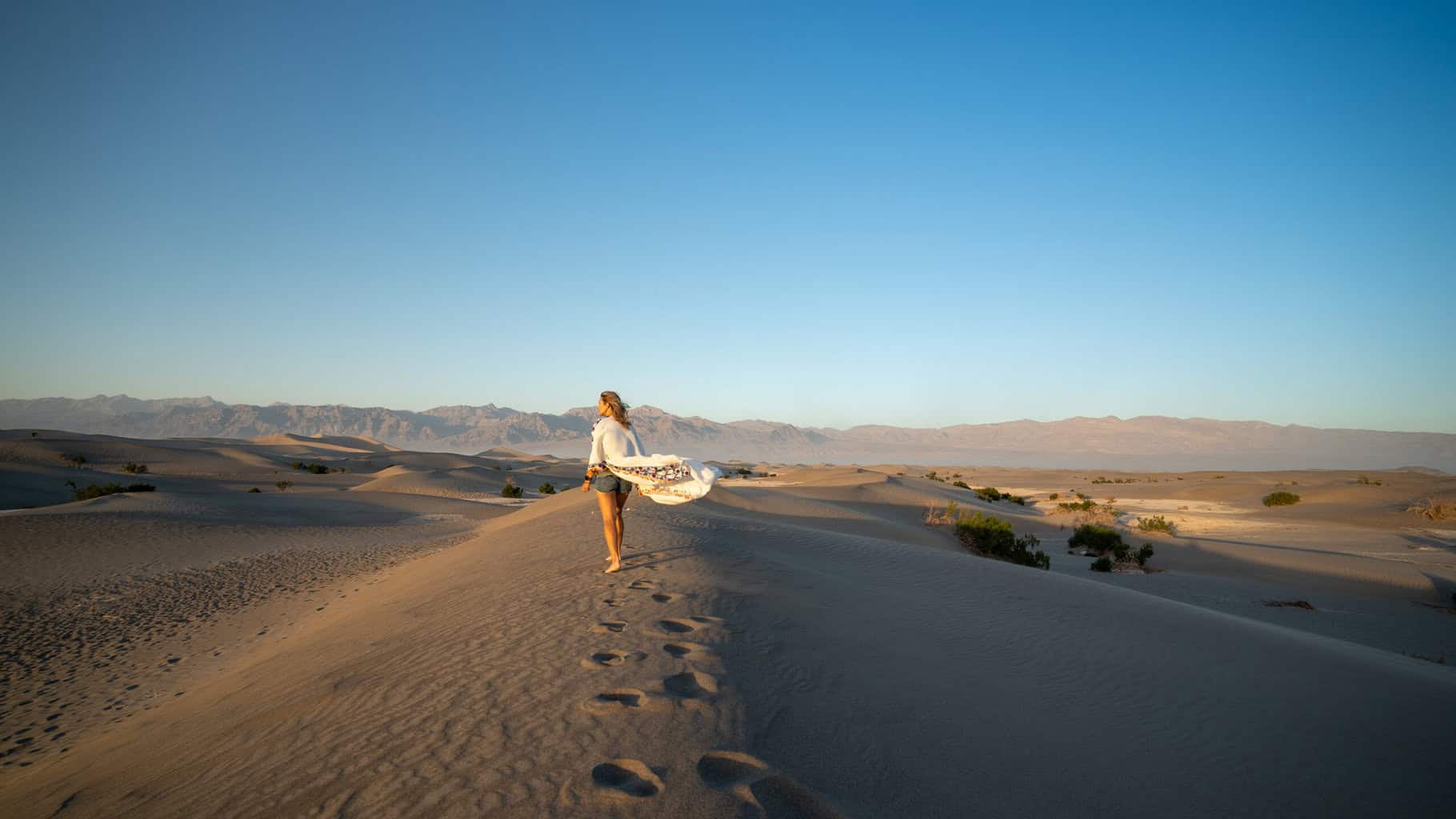
Canyons, volcanoes, trickling waterfalls, and secret ghost towns can be found in the hottest place on Earth — Death Valley National Park. While summer visits would be miserable, winter and spring showcase the park’s majestic beauty and formations from sand dunes to craters and canyons.
Mosaic Canyon Trail (Moderate)
This 3.5-mile trail is named for the varied, layered color of the canyon walls, offering dryfalls, rock scrambles, and twisting narrows that have been buffed and eroded to a smooth polish. The canyon is prone to flash flooding, so don’t hike with rain in the forecast!
Badwater Basin Salt Flats Trail (Easy)
Badwater Basin is the lowest point in North America (282’ below sea level). The partially-paved 1.9-mile trail is stunning in any condition, but absolutely amazing if you arrive after a good rain (see what it’s like here). In dry weather, you’ll see the famous salt polygons the park is known for.
Things to Consider
Spring and winter offer the coolest weather to hike in Death Valley, but spring is awesome with colorful wildflowers in bloom (March-April).
You’ll pay an entrance fee ($15-$30) for the park. Roadside and backcountry camping permits are required in some areas, so check here if you’re planning on staying overnight.
Best Pinnacles National Park Hikes
- Best time to visit: Spring & fall
- Requirements: Entrance pass
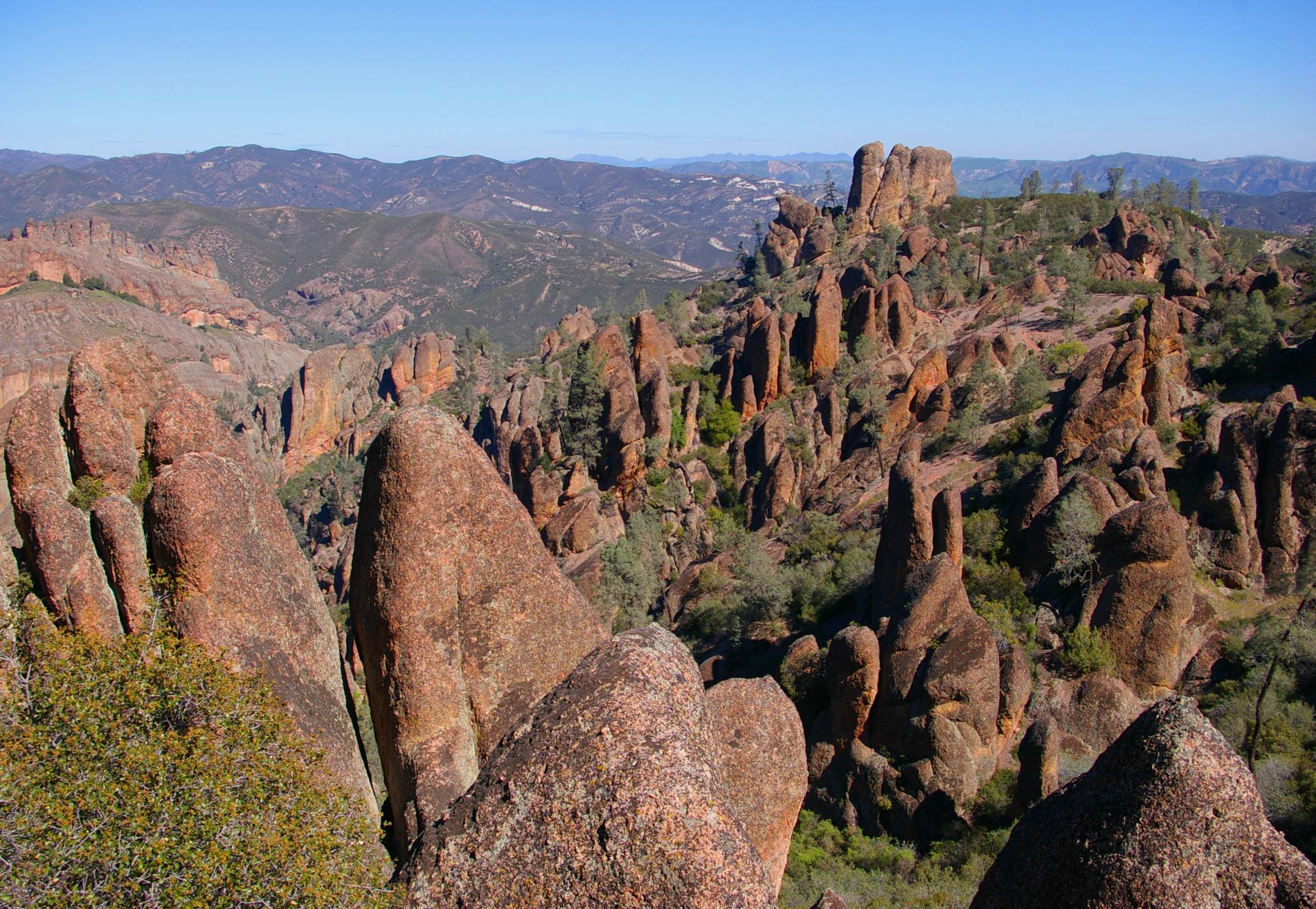
The smallest and newest national park in California, Pinnacles National Park is east of the Salinas Valley and absolutely stunning to hike. You’ll find massive rock spires, rare talus caves, 30 miles of trails, and wildflower meadows here. California condors are making a comeback in the park and can be seen in the early morning or evening from the High Peaks Trail!
Condor Gulch Trail to High Peaks Trail Loop (Strenuous)
With 1,633’ of elevation gain over 5.6 miles, this is a challenging trail that leads to some of the best views in the park — and state! You’ll begin at the Bear Gulch parking area and head on the steep Condor Gulch Trail, see the Bear Gulch caves, and connect to the High Peaks Trail.
Make your way through evidence of the park’s volcanic past with incredible rock formations, ladders, tight squeezes, and panoramic views of the High Peaks. The tallest is 3,000’! Keep an eye out for California condors on this trail.
Things to Consider
Pinnacles doesn’t offer designated backcountry camping, so if you want to stay in the park, you’ll have to reserve a spot at Pinnacles Campground at least 48 hours in advance.
You’ll pay an entrance fee ($15-$30) to get into the park. No permits are required to hike, but reservations are required for camping. Come in spring for the wildflowers and mild temperatures, but fall and winter can be great times to visit (and a little less busy).
Ready to Conquer the Best National Park Hikes in California?
Iconic waterfall hikes, volcanic lavascapes, groves of giant sequoias and redwoods, glimmering caves, and oasis-studded deserts are waiting for you on the best national park hikes in California.
Here’s a 7-day California National Parks Road Trip Route to get you started with many of the best trails on the itinerary! Looking for more trail inspiration? Check out Alice’s guide to the Catalina Trail in Channel Islands National Park next.
Pin this article!





0 Comments